Skymet Weather Forecast April 07: Heavy Rain, Hailstorm Warning for North India; Snowfall in Hills

Representational Image: AI-Skymet
Key Takeaways:
- Multiple weather systems to trigger widespread rain and thunderstorms across India
- Western Disturbance to impact Northwest India from April 7
- Dust storms and hailstorms likely over Rajasthan, Haryana, and Punjab
- Temperatures expected to drop across Northwest, Central, and East India
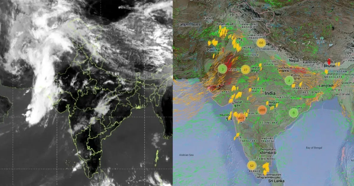
Weather systems over the country
A Western Disturbance is seen as a trough in lower and middle tropospheric winds, with its axis at 5.8 km above mean sea level, running roughly along longitude 79°E to the north of latitude 28°N.
A cyclonic circulation is over West Uttar Pradesh.
A trough extends from Gangetic West Bengal to Telangana across Chhattisgarh at lower levels.
Another cyclonic circulation is over the west-central Bay of Bengal near the South Andhra Pradesh coast at 1.5 km above mean sea level.
A fresh Western Disturbance is likely to affect Northwest India from April 7.
Weather activity during the last 24 hours
During the last 24 hours, light to moderate rain with one or two heavy spells occurred over Tamil Nadu.
Light to moderate rain and thunderstorms occurred over Sikkim, Assam, Arunachal Pradesh, Gangetic West Bengal, Odisha, Chhattisgarh, Jharkhand, parts of Uttar Pradesh, and the Western Himalayas.
Light rain occurred over Vidarbha, South Bihar, coastal Andhra Pradesh, and Kerala.
Weather activity during the next 24 hours:
During the next 24 hours, light to moderate rain with one or two heavy spells may occur over Gangetic West Bengal and Odisha.
Light to moderate rain and snowfall with one or two heavy spells may occur over the Western Himalayas until April 8.
Light to moderate rain and thunderstorms, dust storms, with isolated hailstorms may occur over Rajasthan, Haryana, and Punjab between the evening of April 6 and 7.
Light to moderate rain and thunderstorms may occur over Delhi, Uttar Pradesh, North Chhattisgarh, parts of Madhya Pradesh, Jharkhand, and Andhra Pradesh.
Scattered rain is possible over Tamil Nadu, Kerala, and East Gujarat.
Light to moderate rain and thunderstorms may occur over Northeast India.
Day and night temperatures may drop across Northwest, Central, and East India.
Skymet Exclusive: Risk of Sub-Par Monsoon and drought Over India Rises in 2026