
Throughout the equatorial Pacific Ocean, there is a widespread presence of warm sea surface temperature anomalies, covering the central and eastern Pacific region. However, the atmosphere indicators are quite weak now. While the SST anomalies endorse the continuation of a strong El Nino event, the current status of the Southern Oscillation Index does not align with the characteristics of a powerful event. The traditional SOI currently falls within the ENSO-neutral range. The last recorded mean value of the index for December 2023 was -0.2. The collapse of the atmospheric components from the ocean-atmosphere coupling of the El Nino event may degrade the Oceanic Nino Index (ONI) faster than expected.
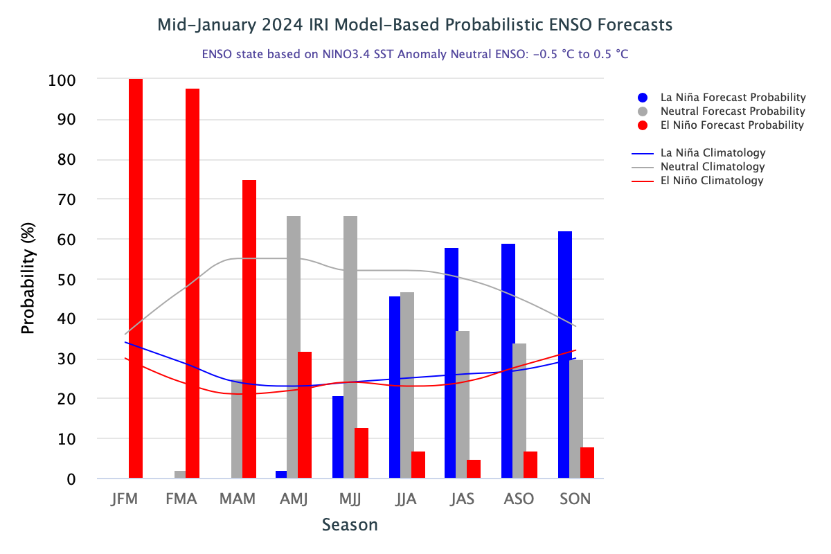
ENSO: An El Nino event is deemed ‘historically strong’ when the temperature anomaly in the Nino 3.4 region equals or exceeds +2.0°C. Such conditions prevailed from Nov 2023 to the start of January 2024. Theoretically, the SST anomaly of +0.5°C or more suffices for the continuation of ENSO conditions. The SST anomaly for Nino 3.4 during the Oct-Dec 2023 season was 1.83°C and for the month of December 2023, it was 1.99°C. The ONI had marginally dropped below the 2°C mark for two consecutive weeks. The most recent weekly (22 Jan 2024) anomaly in the Nino 3.4 region was 1.7°C, a sharp drop from its earlier consistent mark of 2°C.

From the last week, there has been a marginal drop in all four Nino indices. The ENSO prediction plume indicates moderate El Nino conditions persisting during the 1st quarter of 2024. Thereafter, a rapid decrease is expected and a transition to ENSO neutral is likely in 2nd quarter(Apr-Jun). La Nina may become a dominant category during the last leg of the forecast period.
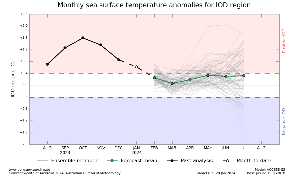
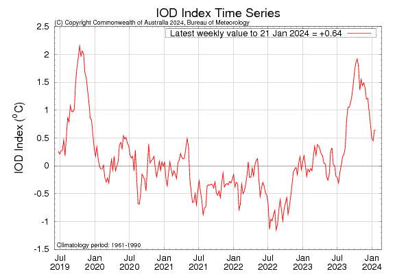
IOD: Sea surface temperatures were warmer than average across much of the western half of the tropical Indian Ocean. The breakdown of the event commenced in Dec 2023. Courtesy strength of IOD and the power of El Nino this season, this breakdown has been later than usual. Also, the process of normalization is topsy-turvy. Sustainable cooling will happen but not without restraint. The IOD index is 0.64°C for the week ending 21 Jan 2024, similar to the previous week. The event is nearing its end and the anomaly may crash below the threshold, anytime soon.
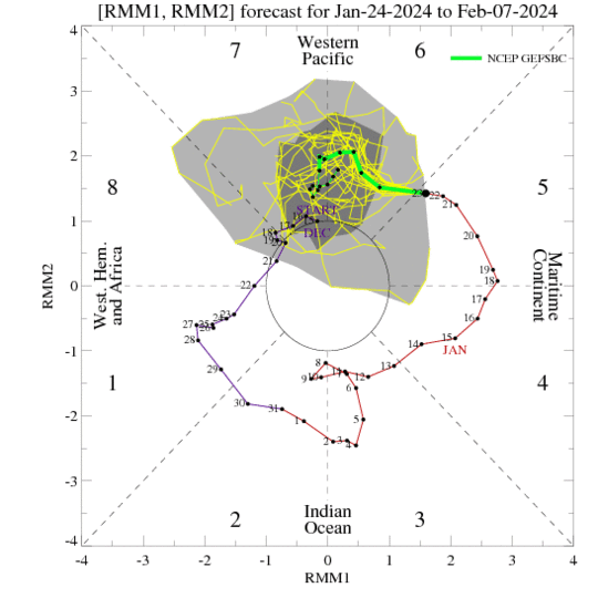
MJO: A coherent phase of Madden-Julian Oscillation was evident as it propagated eastward over the Maritime Continent and into the Western Pacific. However, the high amplitude of the pulse is likely to weaken and also slow down considerably. The northern parts of the Indian Ocean may remain silent without enhanced convection. However, the South Indian Ocean may see increased cyclonic activity with disturbed weather conditions east of Madagascar. Indian seas will remain benign with minimal weather activity over the South Peninsula.
El Nino projection is an ensemble forecast and considers only the mean of predictions of a range of models. Individual models may have some inherent biases and varying model physics. Also, at longer leads, the skill of models degrades. All this, coupled with some uncertainties in the initial conditions may distort the probability distribution. Therefore, caution is always advised in interpreting the forecast distribution.


