
Gujarat was reeling under hot and dry weather till June 11 with no rains to be seen over the state. The deficiency in the state was 100%. However, in thewake of CycloneVayu which formed on June 11 over the East-central and Southeast Arabian Sea, scattered rains were observed.
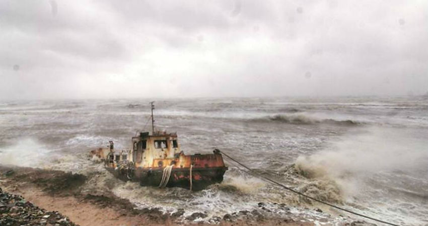
These rains began on June 12 and thereafter intermittent rain and thundershowers continued.Cyclone Vayuas anticipated did not impact the state of Gujarat. It recurved to Northwest before reaching the Porbandar coast and was then almost at a distance of 70 km. However, Cyclone Vayu did give good rains over many parts of Gujarat. At present Saurashtra and Kutch is merely deficit by 5% which has improved solely because of Cyclone Vayu. Earlier, Gujarat hardly witnessed hardly any rains and was mainly dry.
In the past 24 hours as well,Suratand Porbandar recorded 7.4 mm and 9.7 mm of rains, respectively. At present,Cyclone Vayu has weakened into a well-marked low-pressure areaand is over the Kutch region. It will move in the Northwest direction towards South Rajasthan and will weaken further. Thus, good rains are expected over the Kutch region for the next 24 hours. Thereafter, there will be a significant decrease in rainfall.
In other words, we can say that Cyclone Vayu worked as a boon for the state of Gujarat by improving its rainfall deficiency levels. Due to the rains, soil moisture and the water level have been replenished. The normal onset date of Monsoon to touch South Gujarat is June 15. However, it is still hovering around Karnataka and Kerala. As per the experts, Monsoon will be delayed for another five to six days.
Weather Alert For Gujarat
Light to moderate rain and thundershower with strong winds (50-60 kmph) will affect at many places of Diu, Ahmedabad,Amreli,Anand, Aravali, Banas Kantha, Bharuch, Bhavnagar, Botad, Devbhumi Dwarka, Dohad, Gandhinagar, Gir Somnath, Jamnagar, Junagadh, Kachchh, Kheda, Mahesana, Mahisagar, Panch Mahals, Patan,Porbandar,Rajkot, Sabar Kantha, Surendranagar and Vadodara during next 24 hours.
Image Credit: The Indian Express
Please Note: Any information picked from here must be attributed to skymetweather.com


