Unusual Weather Activity In Rajkot: Freak Hailstorm Lashes Large Area

Key Takeaways:
- Rare interaction of multiple weather systems triggered widespread severe weather across Northwest and Western India
- Rajkot recorded an all-time highest rainfall of 38 mm in a short duration, breaking historical records
- Severe thunderstorms, hailstorms, and strong winds impacted Gujarat and adjoining regions
- Weather systems have shifted eastward, with another similar system expected in 2–3 days
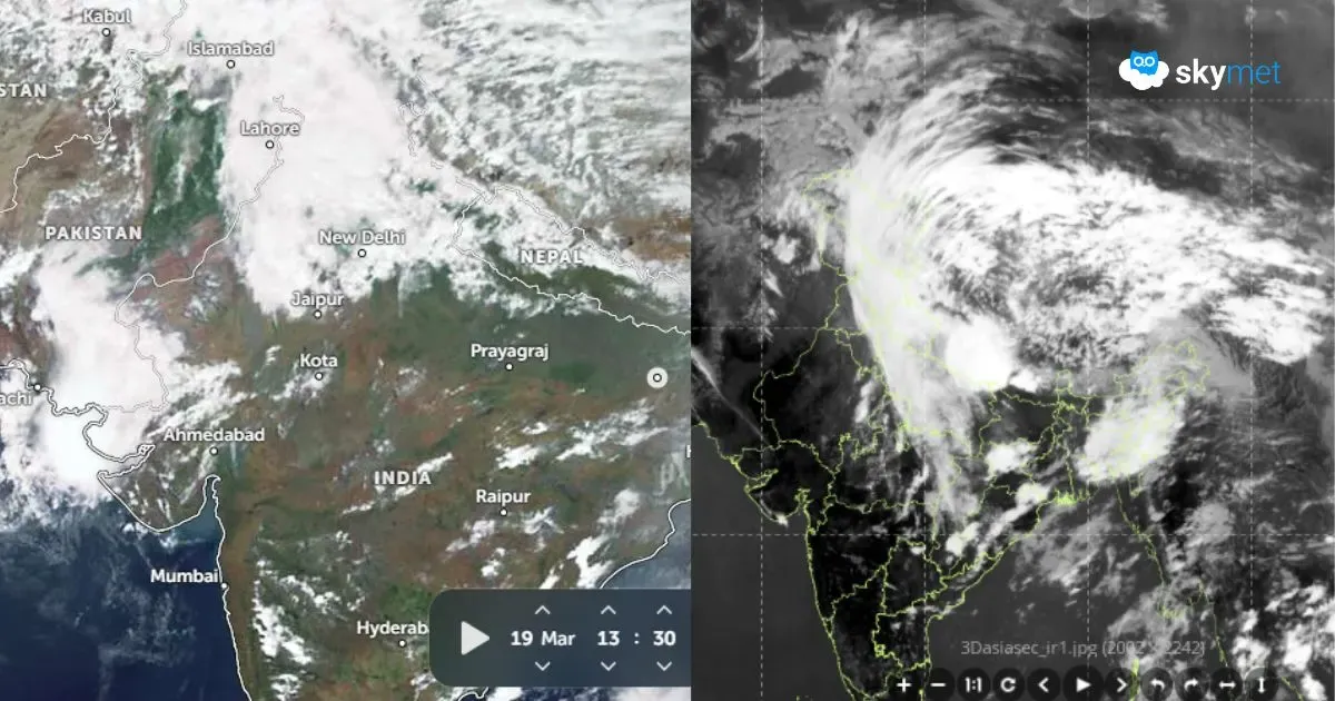
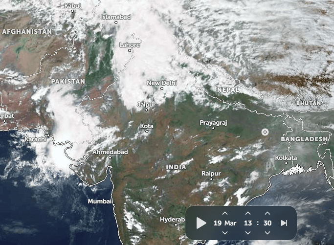
An unusual weather pattern has struck large parts of Northwest and Western India. The weather activity has also encroached upon neighbouring regions of Pakistan and Afghanistan. The anomalous phenomenon brought intense rainfall, severe thunderstorms, gale-speed winds, and hailstorms. Atypical weather activity around this time of the year, over such a large area, is an outlier. The change in the weather pattern during the second half of March has reversed the early heat that had set in at the start of March over North and West India, covering states of Punjab, Haryana, Delhi, Rajasthan, and Gujarat.
Case in point here is the strong interaction of multiple systems getting juxtaposed and creating extended bands of rain and clouds across northern, northwestern, and western parts of the country. This was a case of interaction between an extra-tropical system and mesoscale systems over the tropical region. There was a Western Disturbance affecting large parts of Pakistan, Afghanistan, Jammu & Kashmir, and Ladakh. The induced circulation was placed over Western and Central Rajasthan. An anticyclone in the lower levels over the Northeast Arabian Sea, off the Gujarat coast, was pumping enough moisture deep into the landmass. To top it all, there was a deep trough, oriented north-south, in the higher levels between 9 and 12 km above mean sea level. This trough, placed slightly behind the surface and low-level system positions, provided divergence in the higher levels. Such a situation accentuates the scale and strength of weather activity.
Many parts of Gujarat witnessed inclement weather activity. In this, Rajkot was struck by a freak occurrence of hazardous weather combining severe thunderstorms, blinding rain, thundershowers, howling winds, and a massive hailstorm. As per historical data, Rajkot has a normal of 0.1 mm rainfall for the entire month of March. In the last 15 years, the city recorded nil rainfall in 12 years. The highest monthly rainfall is 34.3 mm recorded in March 1904, and the highest daily rainfall was 21.6 mm recorded on March 17, 1911. Yesterday, in a very short duration, the city recorded an all-time high rainfall of 38 mm. This becomes an all-time record, both in 24 hours and for the month.
Yesterday, the whole state of Gujarat witnessed unseasonal and abnormal weather activity. Moderate rainfall lashed most parts of Saurashtra & Kutch, including Rajkot, Dwarka, Bhavnagar, Bhuj, Naliya, Deesa, and Ahmedabad. The state capital Gandhinagar and the twin city Ahmedabad witnessed strong surface winds of the order of 40–50 km/h throughout the day. The entire sector from Gujarat to the northern mountains of Kashmir & Ladakh, across Rajasthan, Haryana, and Delhi, remained extremely turbulent in the higher levels between 25,000 and 40,000 feet. Aviators in this sector, particularly on the Delhi–Ahmedabad route, experienced rough flying conditions. So much so, the crew was unable to serve even refreshments on board due to turbulence. Service could be conducted only for a very small window of a few minutes. It was a disturbing and uncomfortable experience throughout for passengers.
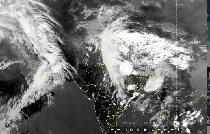
The weather systems have now shifted eastward. The entire longitudinal band of clouds, earlier extending over one thousand kilometers, has also drifted along with it. Conditions have eased for this sector for the time being. Another longitudinal band of similar configuration is currently located over the Middle East region. This is likely to travel across India, Pakistan, and Afghanistan in the next 2–3 days.