
Cyclones form over the oceans within bounds of Tropic of Cancer and Tropic of Capricorn in the Northern and Southern hemispheres respectively. Most of these churn out from the Inter Tropical Convergence Zone (ITCZ), initially as a weak disturbance and grow thereafter utilizing ocean heat potential.
The northern hemisphere is more prone to storms, with West Pacific as the most active basin. Typhoons here are frequent and intense as well. Broadly all oceans in the tropics are susceptible to cyclone formation at this point in time because of seasonality. Indian seas start hosting storms April onward and the probability increases in the subsequent months. The year 2018 saw record 07 storms and this milestone shifted quickly to 2019 with an all-time high of 09 storms in the basins of the Indian subcontinent. Hurricane season of North Atlantic begins on May 01st whereas the appearance of typhoons in the West Pacific coincides with the arrival of Monsoon on June 01st. But there are no official bounds and invariably a storm appears defying these dates.
There are two powerful stimuluses for generation of tropical storm: ITCZ and MJO (Madden Julian Oscillation), ITCZ is a seasonal and semi-permanent feature, whereas MJO is transient in nature and circumscribes the globe in the proximity of equator. The former just needs a trigger to catapult the disturbance while the latter leaves a trail of vortex in the wake, a possible lead to a storm later.
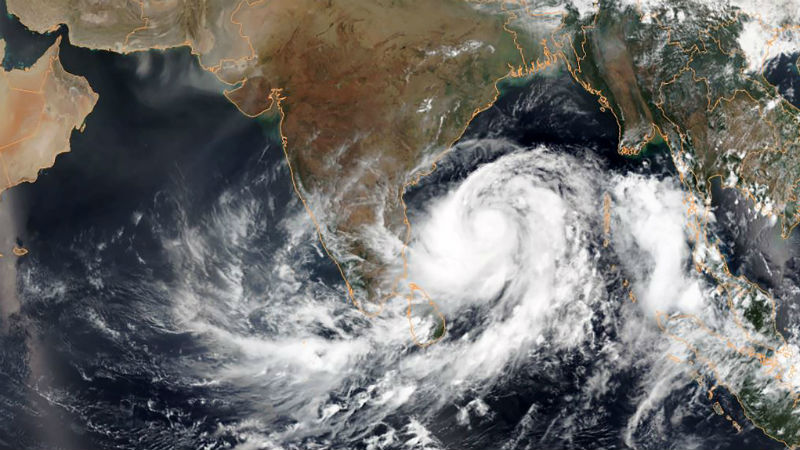
But where have the storms gone this season. The conspicuous absence in the Northern Hemisphere across all the basins including Bay of Bengal and Arabian Sea is little strange. While the cyclones are evading Northern Hemisphere, there is resurgence of stormy activity in the southern half. This discrimination could as well be attributed to the extended stay of ITCZ in the Southern Hemisphere. The presence of strong IOD during winter months led to perennial shift of ITCZ far south of its normal position. This has diluted the cyclogenesis in the neighborhood on the northern side.
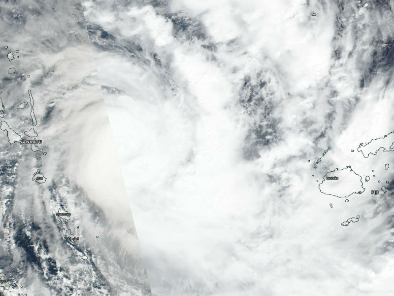
The Southern Hemisphere braced two powerful storms in the first week of April itself. Prior to that, couple of storms battered Australian coastline across Coral Sea, Arafura Sea, Timor Sea and Gulf of Carpentaria. A pair of tropical cyclones developed recently over the Southern Hemisphere. The first system, tropical cyclone 'Irondro' formed over the south Indian Ocean on April 02nd. This system tracked East South East in the basin reaching a peak intensity of 170 km/h on the 4th April. Despite its intensity, Irondro did not impact any landmass. A little later again on April 02nd, tropical cyclone 'Harold' formed near 10degS and 160degE and rapidly intensified until it reached a peak strength of 260km/h on 06Apr. Harold impacted Solomon Island, killing few and missing many, before making a landfall on Vanuatu with severe winds, crippling surge and torrential rains. This Cat V equivalent hurricane ravaged homes and buildings leaving trail of destruction before heading for Tonga and Fizi. This 'superstorm' with winds in excess of 260km/h blasted South Pacific Island nations reducing building to rubble and destroyed the tourist resorts.
What next. After the passage of MJO across East Pacific, there are indications of a vortex developing, propagate westward, gather strength and turn in to cyclone. The Sea Surface Temperature (SST) and wind shear factor is in tune for accentuation and suggest the region is primed for tropical cyclone genesis. But the hindrance, if we may call it so, will be the timings. The East Pacific hurricane season is not underway until May 15th and the region west of Panama has not seen a cyclone develop throughout the historical records during second half of April or the first week of May. But despite such stats, the consensus of numerical models is suggesting elevated chance of storm formation any time after 15th April. Such cyclogenesis is favored in an area west of Panama, paralleling the coast of Central America.
Medium range outlook for the Northern Hemisphere predict benign sea conditions. There are no suspect areas for development of a cyclone. The chance in the next one week looks least and remain smallest even thereafter in the following one.
