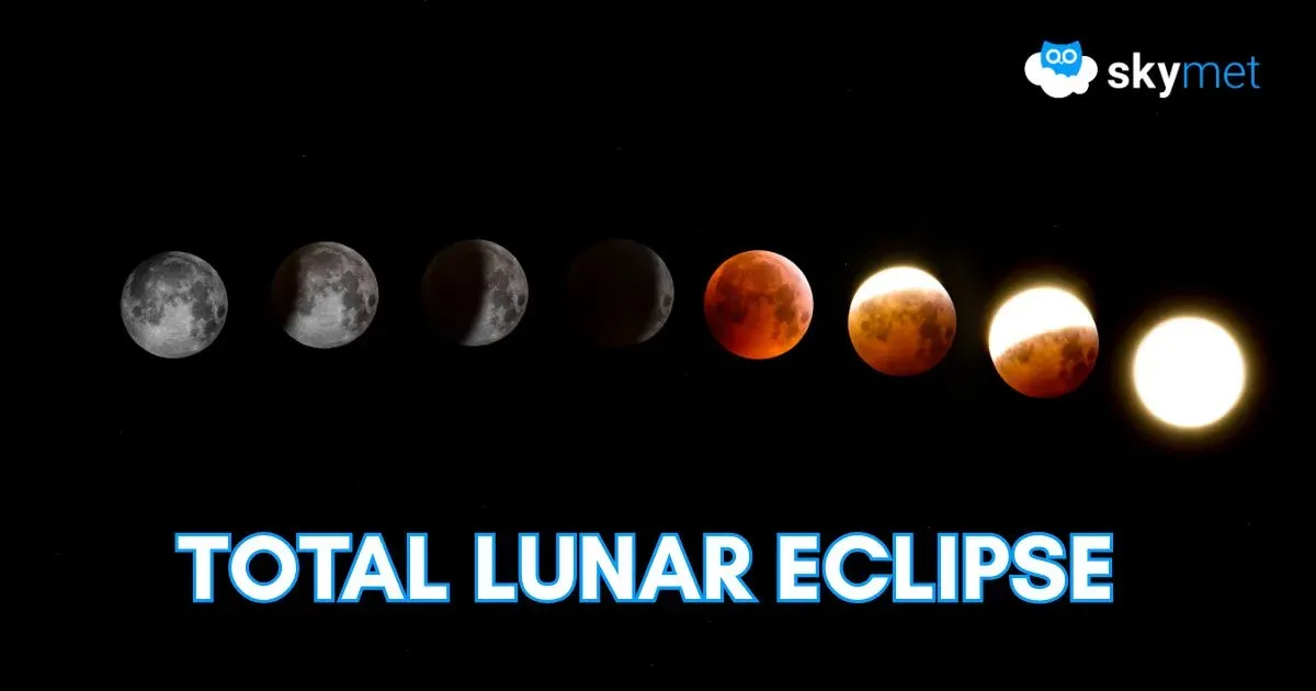
La Nina/ El Nino are the important tools but they cannot pronounce a mandate, every time. During El Nino, the nations bordering the West Pacific including Indonesia and Australia experience hotter and drier conditions. Indian Monsoons and rains in South Africa also get suppressed. La Nina, by no means, is a reverse of all this and much depends on the timing and the strength of the event. Weak or mild La Nina and more so, when short-lived, may at times prove inconsequential. No two La Nina or El Nino years, having the same intensity will have a similar impact, be it the California or the Seaboard of the US or the hinterland of the core monsoon zone in India. The El Nino Southern Oscillation is the Earth’s main source of year-to-year climate variability, but its response to global warming remains highly uncertain. These all-important events leave some unanswered questions: What starts El Nino/ La Nina: How and why does it terminate: Can we actually predict the natural disasters associated with El Nino/ La Nina: Do we have the ability to predict scale of climate change on account of El Nino/ La Nina: Build capability to read collapse/ growth of the event mid-way through.
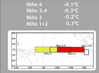
ENSO: Monitoring of ENSO conditions primarily focuses on sea surface temperature anomalies in four geographic regions of the equatorial Pacific. In addition, the thermal expansion or contraction of the water in the Pacific basin measurably raises or drops the sea level in the region. This change in sea level can be measured by satellite sensors, which can supplement the efficacy of the readings by an array of buoys and other ocean-based platforms.

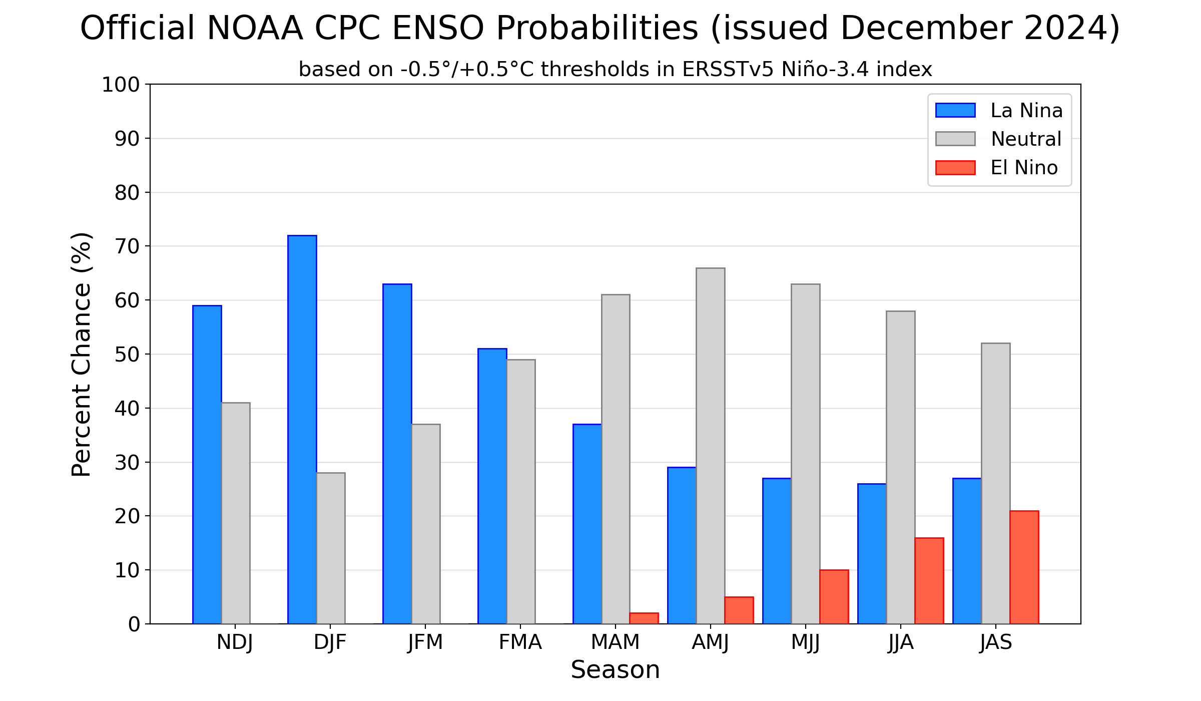
As per the Bureau of Meteorology, the El Nino Southern Oscillation (ENSO) is currently in the neutral range. While not meeting typical La Nina thresholds, some oceanic indices as well as clouds and wind patterns in the Pacific have shown weak La Nina characteristics in the recent weeks. The Nino 3.4, the marker index for ONI remained unchanged at-0.3°C while the other indices cooled marginally. The overall cooling along the equatorial Pacific still remains far from the desired level to make a start with La Nina. Even, after the index reaches the threshold mark of -0.5°C, it will need a consistent and stabilized thermal profile, preferably through a deep layer of about 200 meters.
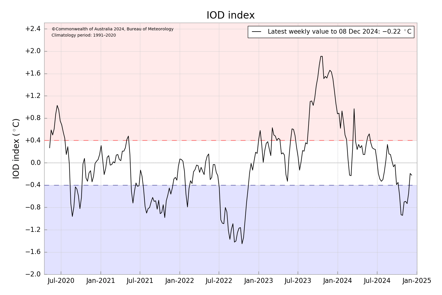
IOD: The Indian Ocean Dipole (IOD) is neutral. The negative trend has been reversed since last week. The latest index value for the week ending 08 Dec 2024 was -0.22°C. Like the typical event, the IOD is likely to remain neutral throughout the forecast period to April 2025.
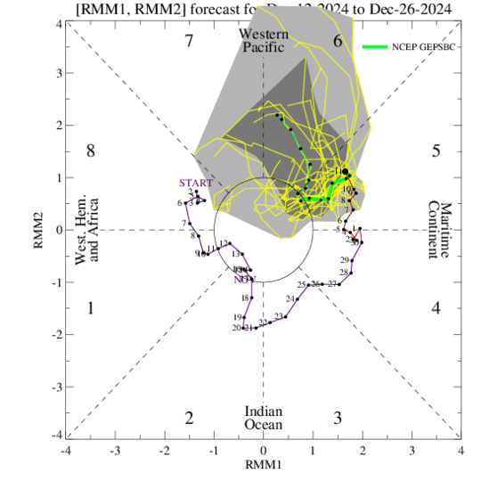
MJO: The Madden-Julian Oscillation pulse will navigate eastward from the Maritime Continent to the Western Pacific, without compromising much on the amplitude. However, the growing La Nina response and negative IOD index may partially, albeit briefly, disrupt its strength. The positioning of MJO remains favourable for enhancing the convection all along the stretch of the Bay of Bengal, from the Malay Peninsula to the Comorin region. The convective zone may even travel further from the Lakshadweep region to the Horn of Africa, through the southern equatorial parts of the Arabian Sea. Either side of the Indian coastline is likely to remain an active basin till the last week of December 2024.
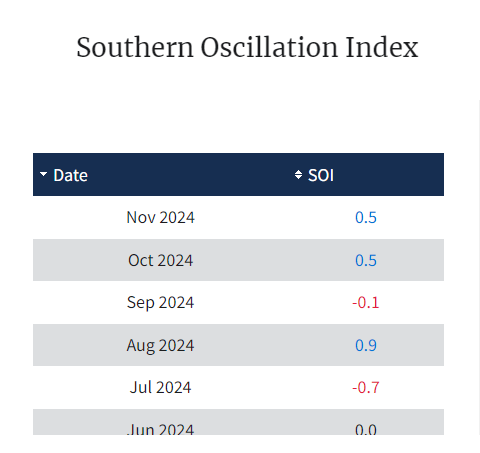
The prediction of La Nina has been rather wavering, this season. The hydrodynamic coupled ocean-atmosphere models and the robust statistical models need to further sharpen the skill set, to decode and capture early signs of La Nina/ El Nino. Notwithstanding, saying is easier than resolution and therefore, the meteorologists will have to live with the predicaments of the modelling field.


