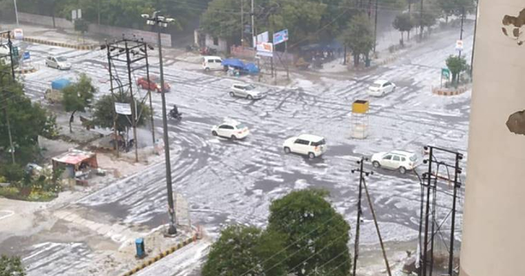
Winter rains have remained far and few over plains of North India, this season so far. Wait is getting shorter now, as an active weather system approach, together for plains and hills. Combined impact of dual weather system, western disturbance and induced cyclonic circulation always amplify the scale of weather activity.
Typical frontal character of western disturbance invariably spells hailstorm in some pockets around this time. Activity is however conditional and is subject to deep extension of the westerly trough or closed cyclonic circulation in the upper tropospheric levels, slightly rear of the main system marking, in the lower layers. Positioning of these two need to be judiciously and perfectly poised for favourable outcome.
An active western disturbance, as a primary weather system is arriving on 22nd Jan over the Western Himalayas. This is escorted by its induced secondary system as cyclonic circulation over Rajasthan in the lower levels. The duo is finding plenty of support at all levels in the troposphere, traced and tracked at an ideal distance from ground positioning.
Persistent snowfall activity over the hills during last week and its likely continuation during middle of this week has adequately cooled the mid and upper layers of the troposphere. Any further trigger of convection will conveniently lead to formation of hails. An akin situation is building up over the fag end of this week. Approaching western disturbance and its induced low pressure will be closely backed by a deep westerly trough, conveniently placed behind these features.
Hailstorm activity generally occurs in the rear section of a frontal weather system. Cold air dominates this section and the envelope of air undercuts the warm air mass, making it rise at a sharper rate of ascent. Availability of moist air and sub zero temperature facilitate hail formation at heights above the freezing level. Size and number of hail stones depends on the atmospheric configuration.
While, rain and thundershower are avidly awaited by the farmers at this stage of Rabi crops, gusty strong wind are best avoided in their interest. Hailstorm, if any, spells doom for most of these crops. Healthy and stable crops may absorb the ill effects of a short spell and small hails. However, big hailstorm for longer duration may ruin the standing crops. Presence of strong and gusty winds, further damage the cereal crops and result lodging of grain stems. Hilly states of Jammu and Kashmir and Himachal Pradesh and plains of Punjab, Haryana, Delhi and Uttar Pradesh bear the risk of hailstorm activity between 22nd and 24th Jan 2023.


