Upcoming Cyclonic Circulation in Bay to bring back rains in Chennai, Tamil Nadu October 27 onward

October 25, 2019 11:03 AM|

Chennai Rain

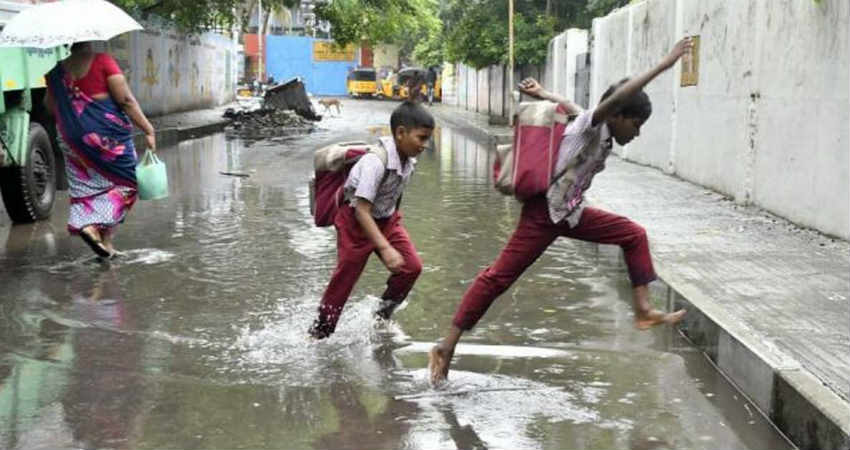
The rain activities have reduced significantly over the entire Tamil Nadu state and during the last 24 hours, no significant rains have been witnessed. However, light to very light rains has been seen over many parts of Tamil Nadu including Chennai. In the last 24 hours, Pamban recorded 5.2 mm of rain, and Coimbatore 0.2 mm.

The reason for these reduced rain activities can be attributed to the reversal of winds due to two major weather systems over the Arabian Sea and the Bay of Bengal.

TheCyclone Kyarrover the east-central Arabian Sea is enhancing the south-westerly winds over Kerala but almost dry westerly winds are prevailing over Tamil Nadu. As per our experts, no significant increase in rainfall activity is expected over the state for at least the next two days.

Therains are likely to increase marginally on October 27. On October 28 and 29, there can be moderate rains with one or two heavy spells over the coastal stations of Tamil Nadu including Chennai. These activities will be in wake of a Cyclonic Circulation over Southwest and Southcentral Bay of Bengal. A trough from this system will extend up to the South Coast of Tamil Nadu.

We can say that after a lull of two-three days, rains will once again pick up the pace. Around October 28 and 29, the rain activities will be subdued over the interior region.

At present Tamil Nadu is the only state which is in normal rain category with a surplus of eleven percent whereas all other southern states are either excess or large excess.

Image Credits – The Hindu

Any information taken from here should be credited to Skymet Weather

Similar Articles

thumbnail image
March 20, Today Marks The Spring Equinox: Day-Night Duration Nearly Equal

The official transition from winter to spring, known as the SPRING EQUINOX, occurs today! It’s time when the Sun crosses the celestial equator precisely at 2:31 PM, delivering warmer, longer days to the Northern HemiSphere. As autumn arrives, the South enjoys colder evenings.

posted on:
thumbnail image
आज सूर्य करेगा भूमध्य रेखा पार, बसंत ऋतु की शुरुआत, दिन-रात की अवधि लगभग बराबर

आज, 20 मार्च 2025, बसंत विषुव (Spring Equinox 2025) का दिन है। सूर्य भूमध्य रेखा को पार करेगा, दिन बड़े और गर्म होंगे। उत्तर गोलार्ध में बसंत ऋतु की शुरुआत होगी, दक्षिण गोलार्ध में शरद ऋतु का आगमन होगा। वहीं, सितंबर में यह खगोलीय घटना फिर से होगी।

posted on:
thumbnail image
गर्मी का दायरा बढ़ा! ओडिशा, महाराष्ट्र, तेलंगाना और रायलसीमा में 40°C के पार तापमान, राहत की उम्मीद

देश में समय से पहले गर्मी असर बढ़ रहा है। ओडिशा, महाराष्ट्र, तेलंगाना, आंध्र प्रदेश में अभी तापमान से 40°C से ऊपर पहुंच गया है, जिस कारण इन राज्यों में भीषण गर्मी हो रही है। फरवरी 2025, पिछले 125 वर्षों में सबसे गर्म महीना रहा है। कई जगहों पर सामान्य से 6.4°C तक ज्यादा तापमान रिकॉर्ड हुआ है।

posted on:
thumbnail image
दिल्ली में बढ़ेगी गर्मी! शुष्क और तपता रहेगा वीकेंड, बारिश की संभावना हुई कम

दिल्ली में गर्मी बढ़ रही है, पिछले 3 दिनों में तापमान 4°C बढ़ा है। आज अधिकतम 34-35°C, न्यूनतम 17°C तक रह सकता है। मार्च अब तक लगभग शुष्क बना हुआ है, सिर्फ 2mm बारिश दर्ज हुई है। 26-28 मार्च को तापमान 40°C के करीब पहुंचने की संभावना है। वहीं,पश्चिमी विक्षोभ से मैदानी इलाकों में बारिश की संभावना नहीं है।

posted on: