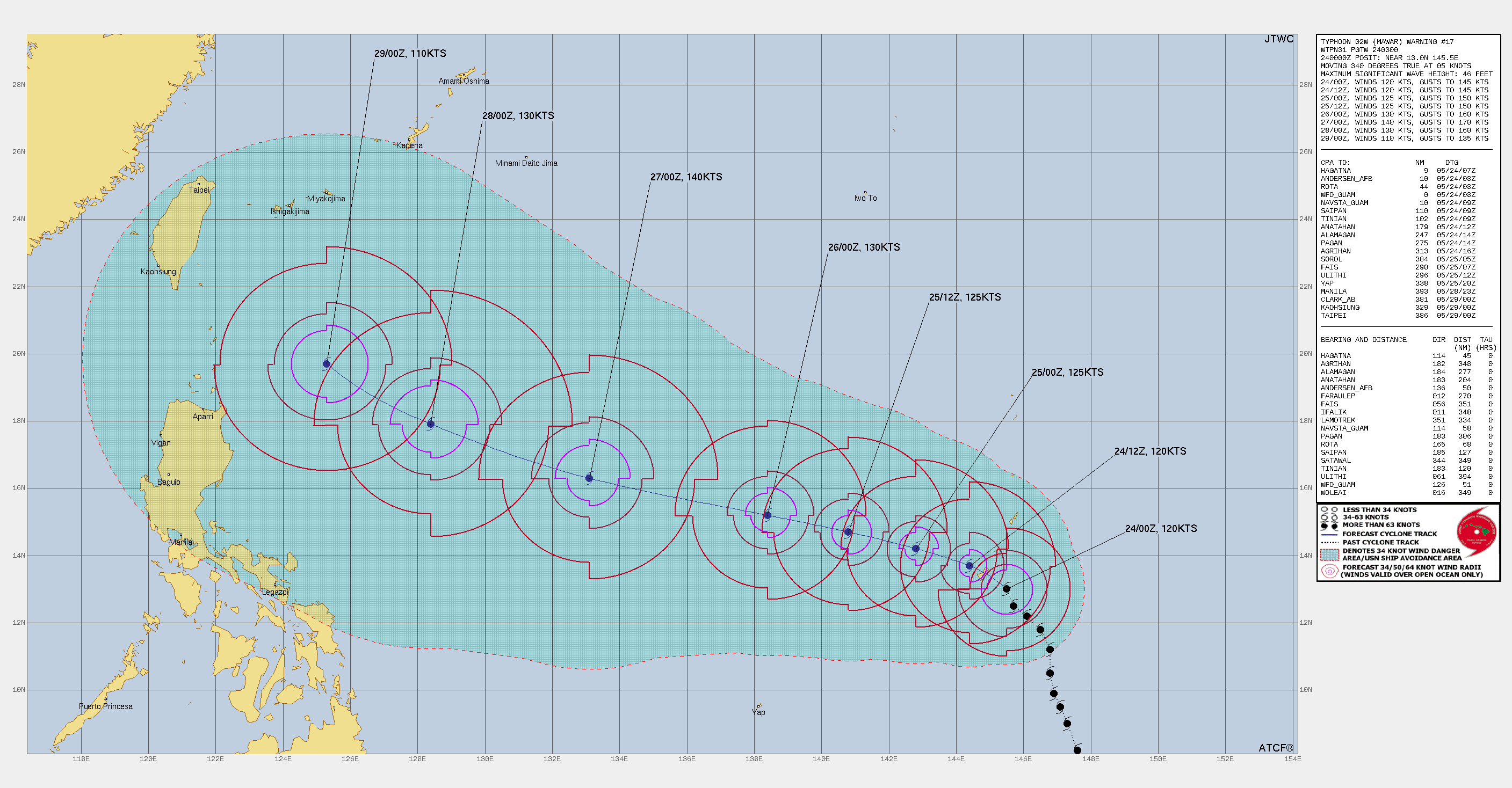
Super typhoon ‘Mawar’ in the Pacific Ocean is centred around 13°N and 145.5°E, about 100km southeast of Anderson Base. The typhoon is bringing the devastating impact of gale winds, flooding, storm surge and blinding rains across Guam and Mariana Islands. It is likely to cross abeam northern Philippines on 29th May and reach east of Taiwan by 30th May. After that, it is anticipated to recurve north and northeastward. A powerful storm will potentially be impacting Japan later.
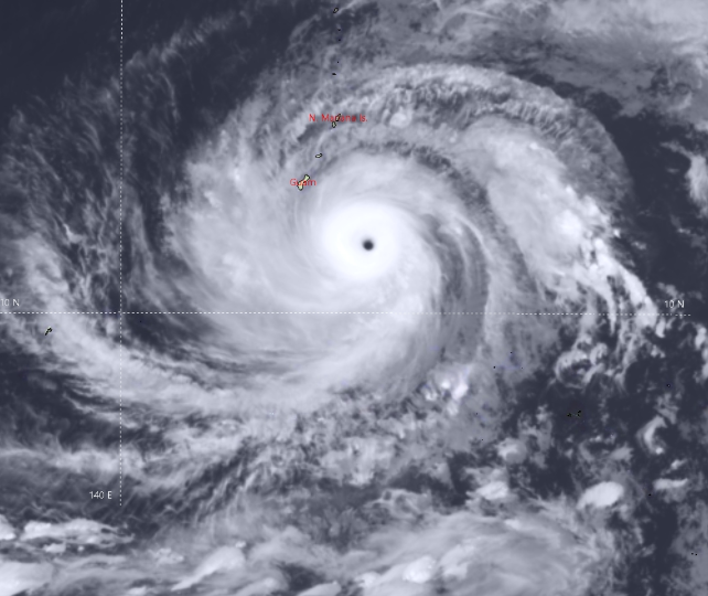
Convective cloud bands of the typhoon are likely to pass over Guam, Rota and Mariana Islands. The storm is having identifiable ‘eye’. It is moving west-northwest towards further warmer waters of the Pacific. Ocean heat content is adequate enough to sustain and counter the dry air entrainment. It is likely to gain strength after clearing these islands. Philippines is expected to escape a direct hit and the typhoon may just brace the extreme northern parts of this storm prone country.

Such powerful storms are not conducive to a smooth monsoon stream over the Indian Seas. These typhoons impact the wind pattern over hundreds of kilometers which invariably depletes moisture over India. Monsoon in India largely depends on low level moisture transport from the Indian Ocean towards the mainland. Sapping of moisture in turn weaken the monsoon flow.
Once the typhoon vacates the East China Sea and heads towards the Sea of Japan, the Indian Seas become propitious to accommodate the strong cross-equatorial flow. There are chances of an ‘Isallobaric Low’ appearing over extreme northeast BoB, travelling from Myanmar across the Gulf Of Martaban during the opening days of June. This feature needs close monitoring for any sustainable development over the ocean. Quite possibly, it may become instrumental in pulling the monsoon winds closer home.