Bihar has been witnessing goodMonsoon rain and thundershowerfor the past few days due to which the rainfall deficiency in the state as of today stands at a meagre 6% (+/- 19 considered normal). In the last 24 hours, Chhapra, Forbesganj, Muzaffarpur, Patna, Supaul and Purnea recorded 129 mm, 152 mm, 58 mm, 25 mm, 30 mm and 13 mm of rains, respectively.
Presently, moderate to heavy rains are still going on. We expect the intensity to increase further as a Low-Pressure Area is over Northeastern Uttar Pradesh and adjoining Northwest Bihar. Hence, heavy to very heavy rains will be a sight in the northern districts of Bihar. While light to moderate rains with one or two heavy spells will be seen in South Bihar for the next 24 hours.
Thereafter, light to moderate rain along with a few heavy spells might continue to be observed at many places in Bihar until July 15 or July 16. Simultaneously the foothills of Nepal will receive very heavy rains. The Simara Airport in Nepal has already recorded 206 mm of rains in the past 24 hours while Okhaldhunga recorded 107 mm of rain. Now, we expect more rains in Nepal and as well as over the foothills of Bihar.
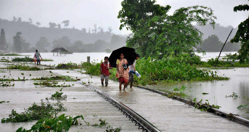
The water level is also likely to rise in the rivers like Ghagra, Gandak, Bagmati, Kamala, and Kosi which in turn would lead to the inundation of many districts of Bihar.Paschim Champaran, Muzaffarpur, Madhubani, Sitamarhi, Araria, Supaul, Katihar and Purneaare flood-prone areas and will be on alert because of the same.
According to weathermen, rains will start receding July 17 onward. Until then heavy rains may trigger floods in Bihar. With such heavy rains in offing, Bihar will be rain surplus in the coming four to five days,
Image Credit: DD News
Please Note: Any information picked from here must be attributed to skymetweather.com


