United States weather agency, Climate Prediction Center( CPC), anticipates the continuation of El Nino through the Northern Hemisphere spring (Mar-May 2024). Australian Bureau is also aligned with a similar forecast and expects El Nino to persist until, at least the end of February. The different time periods of the two agencies can be attributed to the exclusive threshold marker of defining El Nino. While the Bureau of Australia considers +0.8°C as a threshold, CPC treats +0.5°C as the ‘brink’ value. Threshold for Indian Ocean Dipole (IOD) remains the prerogative of Bureau of Meteorology-Australia and Jamstec ( Japan Agency for Marine-Earth Science and Technology). The threshold mark for IOD is settled at +/- 0.4°C.
In the Indian context, El Nino and IOD impact is considered limited to the four-month-long southwest monsoon season from June to September. However, both these oceanic parameters result in large climatic fluctuations around the globe, in different time frames. ‘Super’ El Nino and ‘Great’ IOD, are both brewing in the Pacific and Indian Ocean respectively. Possibly, the peak is yet to come. The likelihood of a robust El Nino during the fall of the year or early next year stands at 75%-80%, wherein the equatorial SST’s could be at least 1.5°C higher than the average for an extended period. There is also 30% chance that temperatures may exceed 2°C, resembling the strong El Nino event of 1997-98 and 2015-16, which caused extreme heat, droughts and floods, worldwide.
Positive Indian Ocean Dipole is still rising and has reached its 6th highest weekly index value since records for the Bureau SST data set began. Earlier, the highest value of the index touched an all-time high of +2.15°C during the week 07-13 October 2019. The IOD index is +1.92°C for the week ending 15 Oct 2023. When a positive IOD and El Nino occur together, their drying effect is typically strong and more widespread across Australian spring and monsoon.
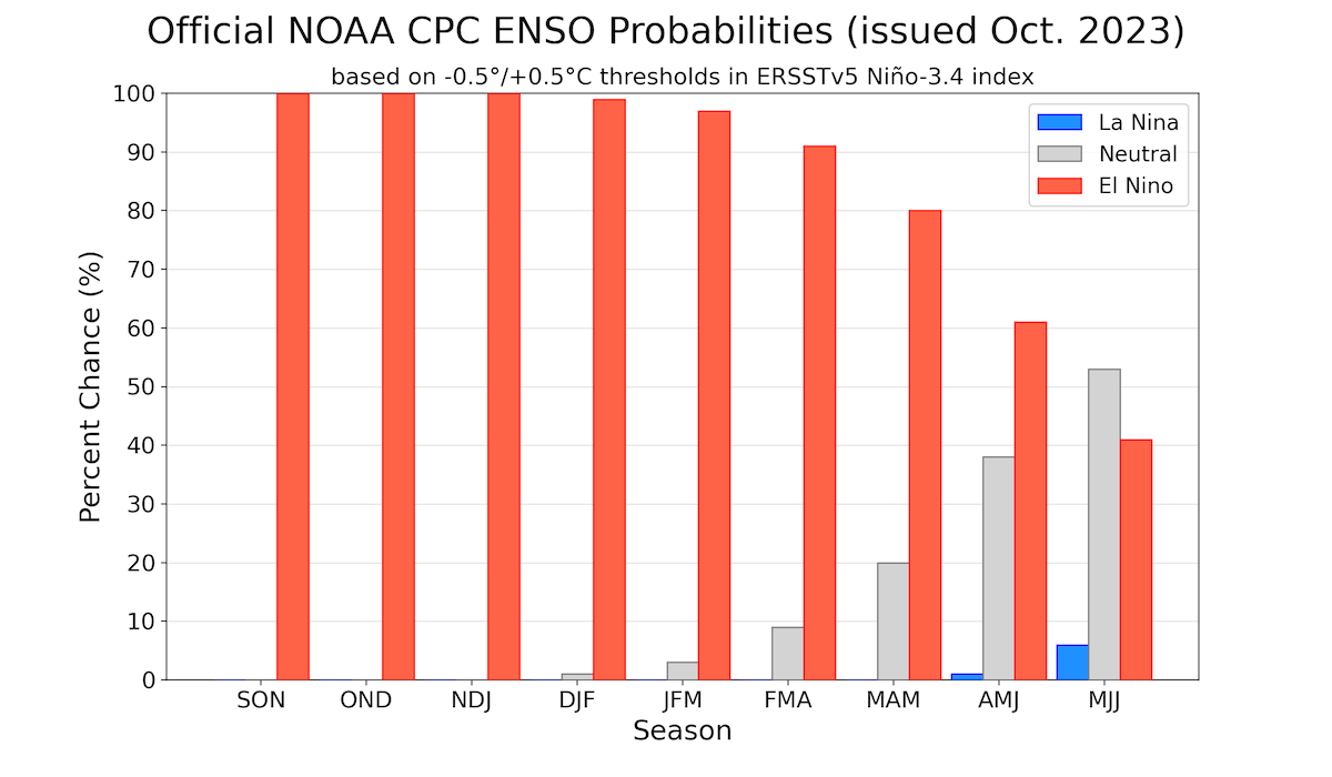
ENSO: Equatorial sea surface temperatures (SST’s) are above the average across the central and eastern Pacific Ocean, the latter being much warmer than the former. Oceanic Nino Index (ONI) represented by the Nino 3.4 region continues to be warmer by >/= 1.5°C for the 8th consecutive week. Persistence of such high temperatures for 12 weeks or more stipulates ‘Super’ El Nino. This is quite likely during the current episode.
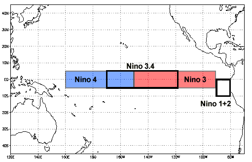

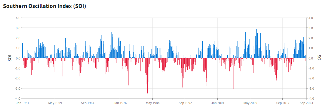
ENSO is an ocean - atmosphere coupling. Southern Oscillation Index (SOI) represents the response of atmosphere to the Nino conditions. There are ample signs of atmosphere responding favourably to the warm SST’s over the Pacific. Coupling of ocean and atmosphere seems to be fairly strong.
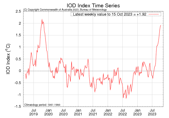
IOD : IOD is an ocean-atmosphere interaction, very similar to the El Nino fluctuations in the Pacific Ocean. But, it is a much weaker system than El Nino and thus has relatively limited impact. Notwithstanding, the positive IOD does have the potential to offset to a small measure in the neighbouring areas. Currently, the positive IOD is continuing to strengthen. The IOD index value was 1.92°C for the week ending 15Oct 2023.
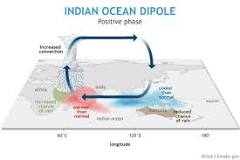

Super El Nino and strong positive IOD spell double whammy for Oceania continent. This deadly combination typically leads to reduced spring and early summer rainfall, for eastern Australia and warmer days for the southern parts of the country.
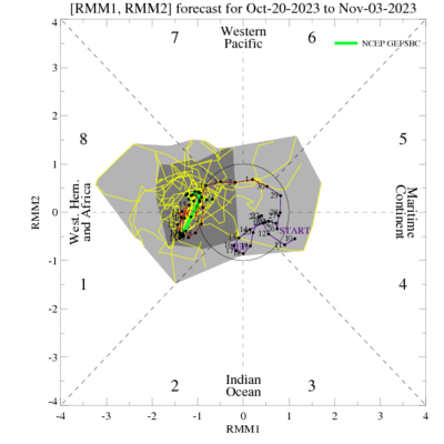
MJO : The Madden-Julian Oscillation has shown signs of renewed activity since early October. Continued eastward propagation of MJO, over Phase 1&8, with marginal amplification in magnitude augurs well for the monsoon activity over Indian Seas. However, there is good deal of uncertainty with respect to the strength and evolution of intra-seasonal activity on account of MJO. Strong +VE IOD riding over super El Nino is driving the global tropical convective activity and relying less on the transiting signal of MJO.
The prospects of ‘Super’ El Nino raises concerns about disturbing typical weather pattern and extreme weather events. In the Indian context, it is observed that El Nino impact is generally less pronounced in Southern India during Northeast Monsoon. Also, onset of winters are expected to be early and the winter rains over North India, generally better.


