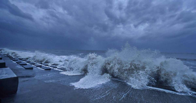
Cyclonic storm is likely to form over Bay of Bengal (BoB), early next week. Potentially, this may spin up to become an extremely severe cyclonic storm (ESCS), record 4th ESCS in the Indian seas this year. Storms over BoB at this time of the year ride on warm sea surface and gather expansive heat potential. Extended sea travel further increase severity and the ravaging capacity. Longer the stay over sea, larger is the fury of storms.
A cyclonic circulation is entering South Andaman Sea from Gulf of Thailand, in the next 24 hours or so. As it consolidates, a low pressure area is likely to form over the same region in the subsequent 24hours. Northern parts of Strait of Malacca, Malay Peninsula and South Andaman Sea is a suitable breeding ground for potential storms. Favourable environmental conditions will stimulate the low pressure to rapidly intensify to a depression first and go on to become a tropical storm by 28th/ 29thNovember 2023.
Indian seas normally find 4-5 tropical storms in a year. Bay of Bengal has slightly bigger share as compared to the Arabian Sea. Last, it was in 2019, when total of 9 tropical cyclones formed, 6 of them in Arabian Sea and only 3 over BoB. The strongest IOD that year could be the trigger. Otherwise, BoB prevails for increased stormy activity, more so, during the post monsoon season. Last year, Arabian Sea did not host any storm and all the 3 found their roots in BoB, one in the pre monsoon and 2 in post monsoon. Prior to that, Indian seas hosted 5 storms each in 2020 & 2021, 3 each in BoB and 2 over Arabian Sea. In 2013 also, all 5 storms formed over Bay of Bengal, giving amiss to Arabian Sea.
Indian seas have evolved 5 cyclones so far. Brewing cyclone will raise the figure to 6, not achieved earlier since 1998: 2018 & 2019 being an exception on account of positive Indian Ocean Dipole. Bay of Bengal will not be ‘done and dusted’ after the current storm, which will be named as ‘Michaung’ and pronounced as ‘Migjaum’. Another cyclone may follow in quick succession, making it record 7th storm in a year. Even, 2nd half of December is not oblivious to cyclogenesis, more so, when the Indian basins appear to be hyperactive. The increase in the activity during November and likely December, is attributable to peaking ‘Indian Ocean Dipole’ and amplifying ‘Madden Julian Oscillation’ over the Indian Ocean.
Bay of Bengal had 3 cyclonic storms this year and Arabian Sea only 2, so far. Total of 3 ESCS together, one over BoB and 2 of these over Arabian Sea. In the pre monsoon season Biparjoy struck Naliya ( Gujarat) and during post monsoon, Tej made landfall in Al Mahrah Govemorate – Yemen. In BoB, all three storms spared Indian coastline. ESCS ‘Mocha’ crossed Sittwe – Myanmar on 14May 2023 and the other 2 storms, ‘Hamoon’ and ‘Midhili’ struck Bangladesh in the post monsoon season.
The cyclonic storms remain dubious of their timelines, track and intensity. Precision forecast of their landfall is possible only couple of days, sometimes even lesser than that, before striking landmass. The climatology and steering current, put together may give a broader picture of their track. As per initial assessment, the emerging cyclone over BoB may gain enough severity to become very severe or extremely severe storm. However, it may skirt the Indian coastline, like its predecessors, and head for Bangladesh. The Andaman Sea and Bay of Bengal will be under close observation for reliable prediction around early next week.