Jammu and Kashmir, Himachal Pradesh and Uttarakhand are the three main pockets which are active throughout the year in terms of weather activity. The altitude ranges from 5,000 ft- beyond 25,000 ft and weather activities vary as per the altitude.
These pockets experience a little breather after the withdrawal of Southwest Monsoon and just before the commencement of winters. Winters start on account of increased passage of Western Disturbances October onward. It will not be wrong to say that little lean period for hills is possibly around September, simply because weather activities are least in hills during this month. Whereas, no hard lines are drawn for the same, there can be variations.
Quickly jumping to this year, the month of October has been a benign one. The least possible weather activity over the hills was observed in the month of October itself.
In the month of October, Jammu and Kashmir was rain deficit by 43%, Himachal Pradesh by 73% followed by Uttarakhand at 94%. On the contrary, the month of November behaved rather very well and now the state of Jammu and Kashmir is rain surplus by 73% and fully recovered it's deficiency. Himachal Pradesh is now rain deficit by just 8% and Uttarakhand still lags behind at 64%.
As per weathermen, low and mid reaches of Jammu and Kashmir, Himachal Pradesh and Uttarakhand are the most contributors to rainfall. Regions lying in the range of 5000 ft-10,000 ft largely contribute to the share of rainfall.
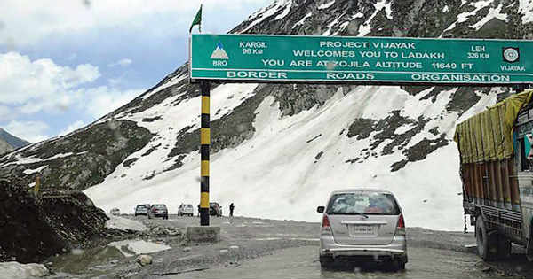
There have been many firsts this season. As we say it is mainly the higher reaches which are prone to weather activities. Zojila Pass and Leh were the first ones to receive first snowfall of this season on September 15. This was followed by Chenab Valley and Doda district which received fair amount of snowfall/thundershowers on September 23.
On November 3, all the three states witnessed snow and temperatures dropped below freezing point to -.4 degree-Celsius in Srinagar. As per meteorologists, this is not a regular phenomena which is seen. Srinagar, mid reaches of Pahalgam, Gulmarg received another spell of snowfall on November 9. Whereas, last year Srinagar received it's first snow on December 12. Since 2009, this year Srinagar received it's snowfall very early.
Usually, the low and mid reaches of all these 3 states are more likely to receive snowfall at the fag end of December.
Another fresh spell of snowfall/rains will be witnessed on November 28-29 in the upper and mid reaches of these 3 states. The rains/snowfall will recover the marginal deficiency of Himachal Pradesh and Uttarakhand will also recover to an extent.
The activities over the hills will set the pace for winters in the northwestern plains of the country.
Image Credit: DNA India
Please Note: Any information picked from here must be attributed to skymetweather.com


