Although the peak Winter season of ‘Chillai Kalan’ is over on January 31 only, the cold doesn’t seem to take an exit from the northern hilly states as of now. According to Skymet Weather, ‘Chillai Khurd’ might have taken over January 31 onward, however the heaviest spell of the season is yet to be observed.
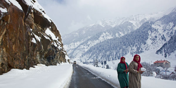
As predicted by Skymet Weather, a prolonged snow spell was expected on February 5 to 8 and rightly so, it’s been raining and snowing in the hilly states of Jammu and Kashmir and Himachal Pradesh since last 24 hours. The state of Uttarakhand didn’t receive any rains yesterday, however, today morning onward it has been raining here as well. Today, all the three states have been witnessing rainfall activities. This activity will be on its peak tomorrow i.e. Thursday, Feb 7. On the same day, some places like that of Jammu, Samba, Kathua and Udhampur might see some hailstorm activities as well.
February 8 onward, the rains will take a backseat and some few areas will observe light rains, however on February 9, rains and snow will finally recede to their completion.
Snow and rain over the hills will be followed by the risks which they bring along, such as chances of Avalanches and landslides. Road connectivity, and thus tourism are likely to get affected. Its toll would be seen over the daily life which is likely to bear the most brunt of all. Alerts and alarms have rightly been issued by the local authorities.
Looking back, the last snowy spell was observed on January 31. The snow spell of January 23 was the heaviest in the season till now. However, the current spell holds a massive possibility of taking over the previously set records, coming out as the ‘heaviest’ till now. Yet another rain and snowy spell is being predicted after a gap of four to five days, starting February 13.
And as it tells, these good rains have led to the precipitation performance indicators showing satisfactory mark as of now in the trio hilly states.
Image Credits – Travelguru Blog
Any information taken from here should be credited to Skymet Weather