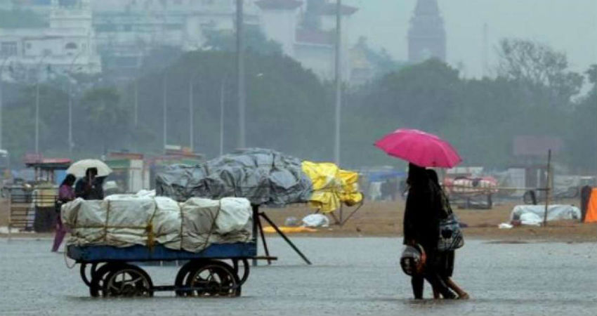
Skymet has issued a red alert in Tamil Nadu considering the chances of heavy rainfall during the next 24 hours in parts of the state. In view of heavy downpour, Fishermen have been advised not to venture into the sea.
Northeast Monsoon continued to remain active to vigorous over Tamil Naduand thus has resulted in heavy to very heavy rains during the last 24 hours.
City-wise, Karaikal has recorded very heavy rains to the tune of 113 mm, followed by Salem 97 mm, Tondi 50 mm, Adirampattinam 45 mm, Madurai 30 mm and Chennai 28 mm in a span of 24 hours from 8:30 am on Monday.
Talking about the weather systems, a Low-Pressure Area has developed in the close vicinity of the state and adjoining areas of Coastal Andhra Pradesh. Moreover, a Cyclonic Circulation is persisting over Comorin Area along with a Trough extending up to Coastal Andhra Pradesh across Low-Pressure Area.
Under the influence of these systems, heavy to very heavy rainfall would continue over Tamil Nadu for another 24 hours. Places like Karaikal, Salem, Tondi, Adirampattinam, and Madurai stand a chance to witness these rainfall activities.The capital city of Chennai would witness moderate to heavy rainduring the same time frame.
After the next 24 hours, rains would taper down, but scattered rain with one or two moderate spells would continue. Similarly, Chennai rains would ease down after 24 hours.
Another good spell of rain and thundershower activities is likely on October 28, in the wake of a Cyclonic Circulation over the Bay of Bengal.
Since the beginning of October, on and off rains have been appearing over Tamil Nadu. Although the intensity remained on the lower side during the first seven days of October, the second week saw a gradual increase in rains. And in the last two to three days, rains have been intense, so much so that the state is standing rain surplus at 3% as on October 21 (rainfall data from Oct 1 to 21).
Image Credits – NDTV
Any information taken from here should be credited to Skymet Weather


