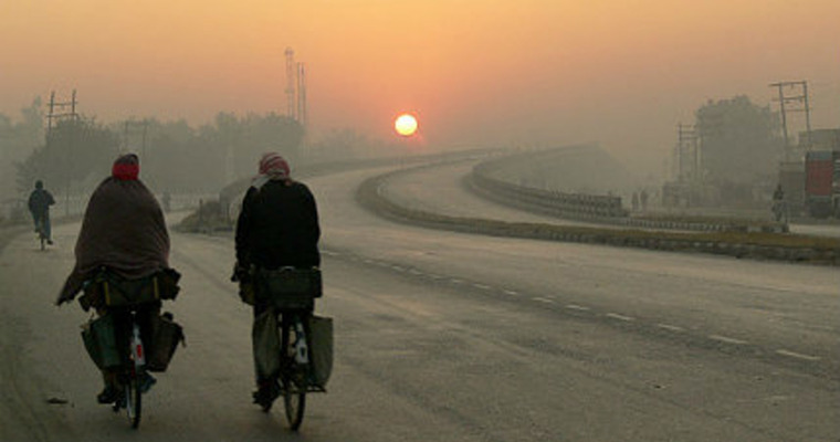
Night temperatures have plunged further over the plains of Punjab and Haryana leading to severe cold wave conditions in pockets of Northern plains. The core area includes perennial pockets of Punjab, Haryana and Rajasthan. Places include Ludhiana, Patiala, Barnala, Pathankot, Jalandhar, Kapurthala, Chandigarh, Ambala, Hisar, Karnal, Panipat Narnaul, Sikar, Pilani, Churu, Alwar and Ganganagar. Ludhiana and Narnaul seem to be the coldest with minimum temperatures of 1°C and 1.8°C respectively. These mercury levels amount to severe cold wave conditions.
A feeble western disturbance is approaching the northern mountains. However, the weather activity will remain confined to higher reaches only. Low and mid reaches may just have some clouding. Plains of north India are unlikely to be impacted by this weather system. Yet another western disturbance will arrive on 20th Jan but will have similar conditions. Marginal changes in the temperature are likely over the next 2-3 days.
A stream of dense fog has been prevailing all along Indo Gangetic plains for the last few days. Delhi remained just on the fringes today. This envelope is lifted only late in the afternoon which does not suffice to raise the day temperatures. The day temperature has dipped to under 10°C at Amritsar, Pathankot and Bhatinda. These temperatures have been 8-11°C below the normal. Ludhiana, Chandigarh, Ambala and Karnal recorded temperatures of 12-13°C. In addition to the widespread cold day conditions, even cold day conditions have accompanied for the last few days. No rains are expected over the entire region for the next 10 days. Ground frost is likely because of the inversion layer in the lower layers of the atmosphere. No major relief is likely during the week, as such.


