Recurving cyclone Vayu to give more rain in coastal Gujarat

June 15, 2019 12:35 PM|

Cyclone Vayu

Thevery severe Cyclonic Storm Vayuis still maintaining its intensity. In the last 24 hours, it has moved slowly westwards and now lies about 260 km west-southwest of Porbandar, 310 km west of Veraval and 360 Km west of Diu.

As the system has come closer to the COL region (where the winds are almost null) and the subtropical reach over Oman has weakened, there is a possibility of the system weakening rapidly in 48 hours.

As the northeasterly winds are strengthening in the higher levels, there is a possibility of theCyclone Vayurecurving as a depression or a well-marked low over the northeast Arabian Sea and gradually moving towards Coastal Gujarat.

In the meantime, Northeast Arabian Sea will continue to experience very strong winds with a speed of 100-110 Kmph gusting at 135 Kmph. While coastalGujaratwill experience 50-60 kmph winds gusting at 80 Kmph, which will gradually weaken.

During this period of two days, rainfall activity will decrease along the coast and the interior parts of Gujarat, while the western parts of the state will continue to receive light to moderate rainfall. Interior parts will observe light rain.

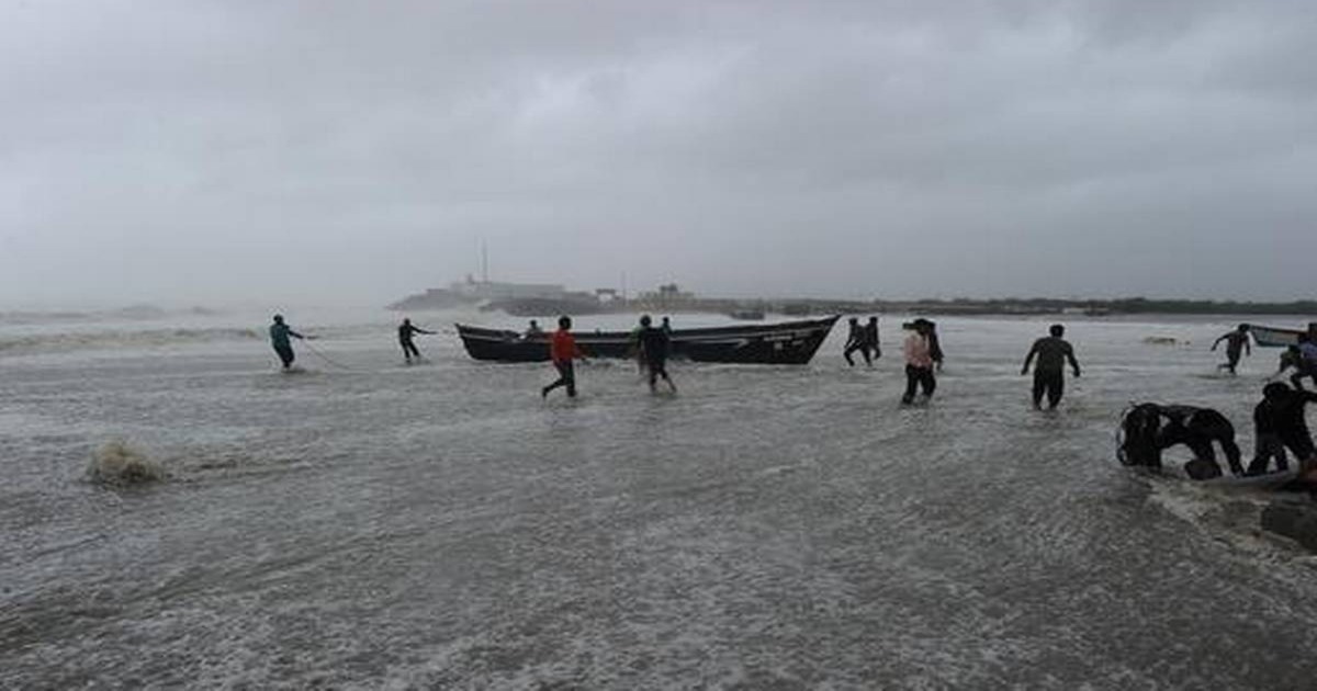
After 48 hours, around June 17, rainfall activity will enhance along the coast of Southwest Gujarat likePorbandar, Dwarka Okha andJamnagar. Good rains will be observed in the region during this period. It is advised that people don't venture out in the sea for at least next 3-4 days.

Image Credit: The Hindu 

Any information picked up from here should be attributed to Skymetweather.com

Similar Articles

thumbnail image
March 20, Today Marks The Spring Equinox: Day-Night Duration Nearly Equal

The official transition from winter to spring, known as the SPRING EQUINOX, occurs today! It’s time when the Sun crosses the celestial equator precisely at 2:31 PM, delivering warmer, longer days to the Northern HemiSphere. As autumn arrives, the South enjoys colder evenings.

posted on:
thumbnail image
आज सूर्य करेगा भूमध्य रेखा पार, बसंत ऋतु की शुरुआत, दिन-रात की अवधि लगभग बराबर

आज, 20 मार्च 2025, बसंत विषुव (Spring Equinox 2025) का दिन है। सूर्य भूमध्य रेखा को पार करेगा, दिन बड़े और गर्म होंगे। उत्तर गोलार्ध में बसंत ऋतु की शुरुआत होगी, दक्षिण गोलार्ध में शरद ऋतु का आगमन होगा। वहीं, सितंबर में यह खगोलीय घटना फिर से होगी।

posted on:
thumbnail image
गर्मी का दायरा बढ़ा! ओडिशा, महाराष्ट्र, तेलंगाना और रायलसीमा में 40°C के पार तापमान, राहत की उम्मीद

देश में समय से पहले गर्मी असर बढ़ रहा है। ओडिशा, महाराष्ट्र, तेलंगाना, आंध्र प्रदेश में अभी तापमान से 40°C से ऊपर पहुंच गया है, जिस कारण इन राज्यों में भीषण गर्मी हो रही है। फरवरी 2025, पिछले 125 वर्षों में सबसे गर्म महीना रहा है। कई जगहों पर सामान्य से 6.4°C तक ज्यादा तापमान रिकॉर्ड हुआ है।

posted on:
thumbnail image
दिल्ली में बढ़ेगी गर्मी! शुष्क और तपता रहेगा वीकेंड, बारिश की संभावना हुई कम

दिल्ली में गर्मी बढ़ रही है, पिछले 3 दिनों में तापमान 4°C बढ़ा है। आज अधिकतम 34-35°C, न्यूनतम 17°C तक रह सकता है। मार्च अब तक लगभग शुष्क बना हुआ है, सिर्फ 2mm बारिश दर्ज हुई है। 26-28 मार्च को तापमान 40°C के करीब पहुंचने की संभावना है। वहीं,पश्चिमी विक्षोभ से मैदानी इलाकों में बारिश की संभावना नहीं है।

posted on: