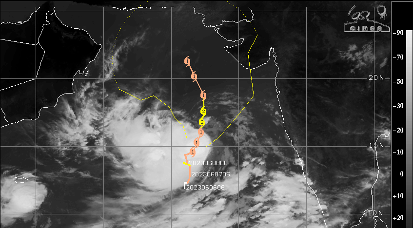
Very severe cyclonic storm ‘Biparjoy’ continue to move very slowly over deep waters of East-Central Arabian Sea. The storm is centred around 15°N and 66.5°E, about 800km west of Goa and 820km west-southwest of Mumbai. Biparjoy will move north-northeast during the next 24 hours and later change track to more northward first and then north-northwest. The storm is having a persistent mass of deep convection and is likely to sustain or grow its strength for the next 24 hours.
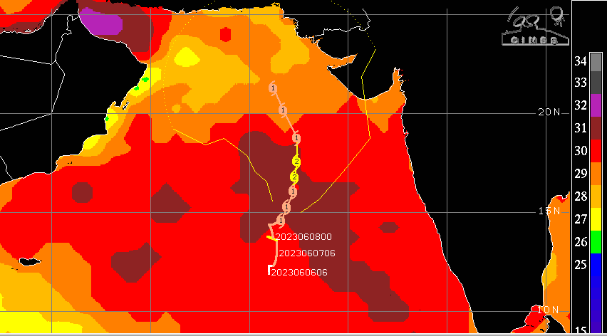
As the storm moves northward after about 36hr, it may show some signs of weakening. There is considerable uncertainty in both track and intensity. The storm will be sailing over deep ocean waters with two opposing steering flows. Courtesy of cyclone Biparjoy, the steering current in the lower and middle levels is strong southwesterly and topped by easterly winds in the higher atmospheric levels. Therefore, vertical wind shear is likely to increase because of opposing flows. Also, the sea surface temperature is likely to drop gradually over the northern parts of the Arabian Sea. Reduction in heat potential will start weakening the storm when it reaches the close proximity of the coastline, irrespective of the region.
Storm is maintaining a safe distance from the West Coast. No heavy weather is expected over Coastal Karnataka, Goa and Konkan regions, including Mumbai. However, strong southwesterly winds from the Arabian Sea will strike the coast with force and fury. Moderate showers are likely along the coastline, right from south to north for the next 4-5 days. This feature will help advance the monsoon over coastal Karnataka, Goa and Mumbai in the next 4-5 days. Sea conditions along and off the coast will be very rough and not advisable for venturing.
There is no agreement between the numerical models about the track of Biparjoy in its final leg. The cone of landfall stretches from Oman, Strait of Hormuz, Pakistan/Iran Makran coast and Rann of Kutch. After crossing the sub-tropical ridge, the storm can get steered to the left or right. More clarity will emerge after 48 hours. The cyclone needs to be kept under observation to monitor intensity and track.