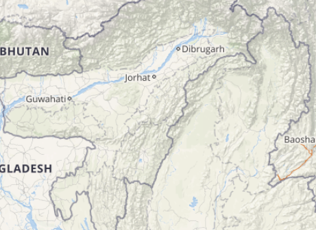
The month of March has proved to be constructive in terms of rainfall for the northeastern parts of the country, mainly for the states of Assam, Arunachal Pradesh, and Meghalaya. Along with this, apart from these regions, the entire zone has been witnessing the good amount of rains.
In fact, Northeast India has witnessed scattered light to moderate showers the second consecutive day. However, the intensity of these showers was moreover Assam in comparison with the other northeastern states which had to be satisfied with some light spells.
Within the span of 24 hours from 08:30 am on Friday,Dhubrirecorded 38 mm of rains, Chaparmukh 30 mm, Silchar 13.8 mm, Shillong 12.2 mm, Goalpara 9.5 mm, Cherrapunji 9 mm, Lengpui 7 mm, Kailashahr 5.2 mm, and Guwahati witnessed light spells to the tune of 2 mm.
[yuzo_related]
As per the weathermen at Skymet Weather, a trough is extending from the eastern parts of Bihar to Manipur across West Bengal and Meghalaya. In addition to this, a cyclonic circulation has also formed over East Jharkhand, Bihar and adjoining West Bengal.
Click here to get the live lightning and thunderstorm status across Northeast India
These rains occurred because of both these weather systems. As of now also, as both these weather systems would continue to affect the northeastern states, therefore, rain activities are likely to continue for the next few days.
However, the rain belt which has already shifted westward is expected to witness a further shift towards the west leading to increased rain and thundershowers activities over parts of West Assam, Sub-Himalayan West Bengal & Sikkim, Meghalaya, and Tripura.
On the other hand, the other northeastern states would continue to get scattered thundershower activities. Thus, March will end on a rainy note and the month of April will also begin on a similar note.
ImageCredit: Wikipedia.org
Any information taken from here should be credited to skymetweather.com


