Rains to increase over Uttar Pradesh

August 17, 2016 1:59 PM|

up rains post

During last 24 hours, most of the central and eastern region of Uttar Pradesh have received moderate to heavy rains.

These heavy showers can be attributed to a cyclonic circulation seen over eastern parts of the state. Moreover, the axis of Monsoon trough is also seen running along the foothills of Himalayas. The eastern arm of this Monsoon trough is seen passing through Uttar Pradesh via Hardoi towardsBihar.

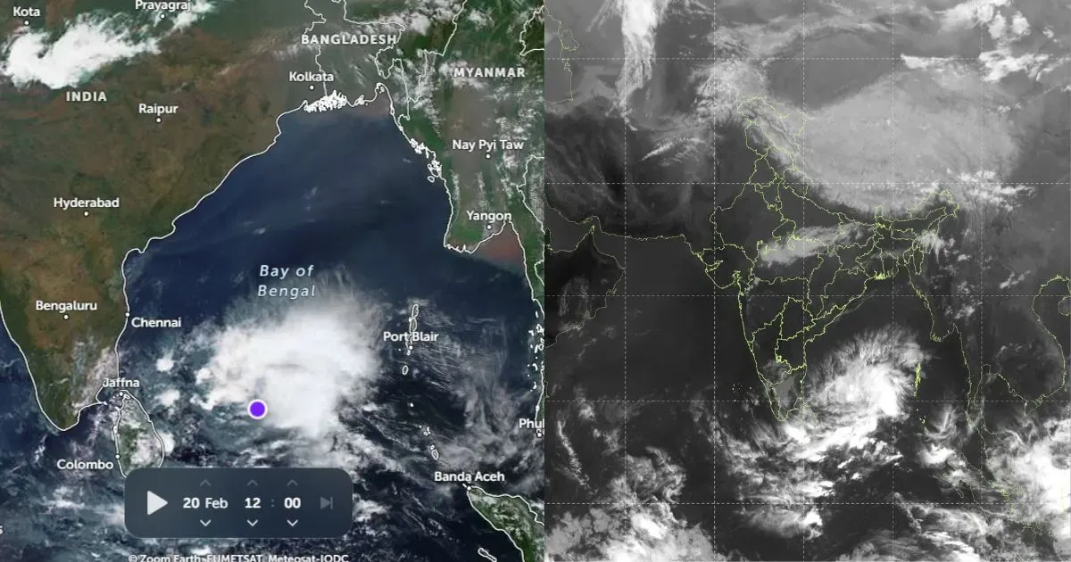
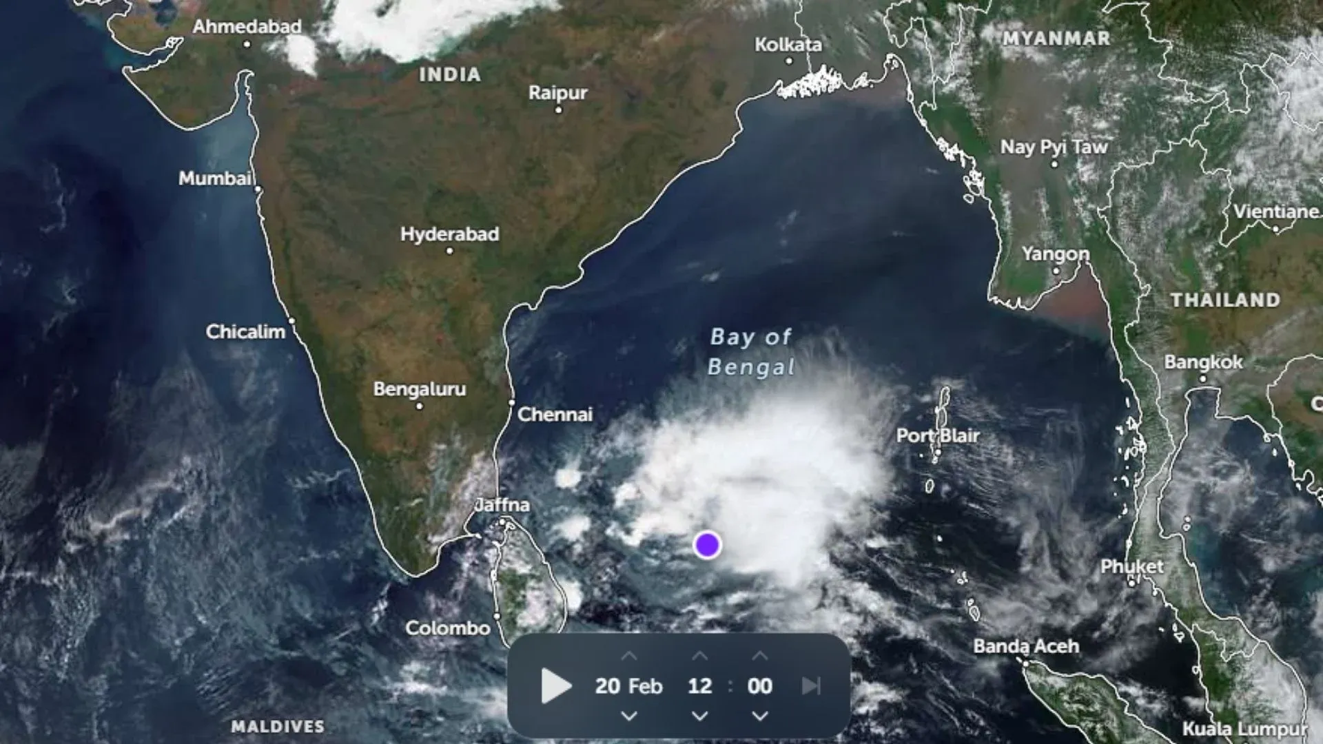
Furthermore, a depression has also formed over northwest Bay of Bengal which is likely to move in a northwesterly direction. This depression is expected to gradually intensify into a deep depression thus affecting the weather ofUttar Pradeshas well.

Additionally, the cyclonic circulation which is at present over eastern parts of Uttar Pradesh is also expected to move westwards increasing rains over West Uttar Pradesh.

Here’s a look at the rainfall observe in a span of 24 hours from 08:30 am on Tuesday:

rains in UP

During next 2-3 days, most parts of the state are likely to receive fairly widespread rains.

These rains will play a major role in enhancing the rainfall statistics that the state is presently enjoying. As on August 16, Uttar Pradesh has already witnessed 537.2 mm rains against the normal of 537.6 mm. Hence, these upcoming good spells are expected to bring the rain stats for the state towards a positive note.

Image Credit: ebrothersblog.wordpress.com

Please Note: Any information picked up from here must be attributed to skymetweather.com


Similar Articles

thumbnail image
March 20, Today Marks The Spring Equinox: Day-Night Duration Nearly Equal

The official transition from winter to spring, known as the SPRING EQUINOX, occurs today! It’s time when the Sun crosses the celestial equator precisely at 2:31 PM, delivering warmer, longer days to the Northern HemiSphere. As autumn arrives, the South enjoys colder evenings.

posted on:
thumbnail image
दिल्ली में बढ़ेगी गर्मी! शुष्क और तपता रहेगा वीकेंड, बारिश की संभावना हुई कम

दिल्ली में गर्मी बढ़ रही है, पिछले 3 दिनों में तापमान 4°C बढ़ा है। आज अधिकतम 34-35°C, न्यूनतम 17°C तक रह सकता है। मार्च अब तक लगभग शुष्क बना हुआ है, सिर्फ 2mm बारिश दर्ज हुई है। 26-28 मार्च को तापमान 40°C के करीब पहुंचने की संभावना है। वहीं,पश्चिमी विक्षोभ से मैदानी इलाकों में बारिश की संभावना नहीं है।

posted on:
thumbnail image
Hot Belt of 40°C Expands: Covers Odisha, Maharashtra, Telangana and Rayalaseema; Relief Likely

Heatwave conditions are setting in much earlier than usual this year, with temperatures soaring past 40°C in Odisha, Maharashtra, Telangana, and Andhra Pradesh. Slight relief is expected as rain and thunderstorms are likely between March 21-24 across several states.

posted on:
thumbnail image
[Hindi] सम्पूर्ण भारत का मार्च 21, 2025 का मौसम पूर्वानुमान

अगले 24 घंटे के दौरान, पश्चिम बंगाल, झारखंड, मणिपुर, मिजोरम, त्रिपुरा और उत्तर छत्तीसगढ़ में हल्की से मध्यम बारिश और गरज के साथ बिजली चमकने तथा तेज हवाओं की संभावना है।

posted on: