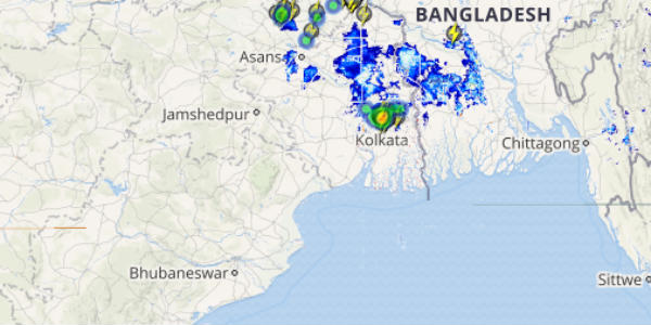
The state of Odisha has received moderate to heavy rains with one or two very heavy spells in the last 24 hours. During the same time frame, northern parts of West Bengal also observed moderate to heavy rains at many places.
[yuzo_related]
In a span of 24 hours from 08:30 am on Wednesday, Jalpaiguri recorded a whopping 129 mm of rainfall, followed by Cooch Behar 106 mm, Baripada 102 mm, Malda 46 mm, Angul 14 mm, Sriniketan 8 mm, Diamond Harbour 7.5 mm, Balasore 4 mm and Bhabanipatna 4 mm.
As of now, one end of axis of Monsoon trough is moving towards Sub Himalayan West Bengal, whereas the other end is heading towards Gangetic West Bengal.
According to weathermen at Skymet Weather, most parts of the state will witness good rain and thundershowers; however the intensity of these rains would be much over Sub Himalayan West Bengal.
Click the image above to see the live lightning and thunderstorm across India
Meanwhile, northern parts of Odisha will continue with moderate rains and the intensity of rains over southern districts of Odisha such as Pulbani, Gopalpur and Titlagarh will remain light.
As on August 9, rainfall over Odisha is near normal. Gangetic West Bengal is rain surplus by 12%, while Sub Himalayan West Bengal is rain deficit by 15%. We expect the rain figures of West Bengal to improve further.
IMAGE CREDIT: tourmyindia.com
Any information taken from here should be credited to skymetweather.com


