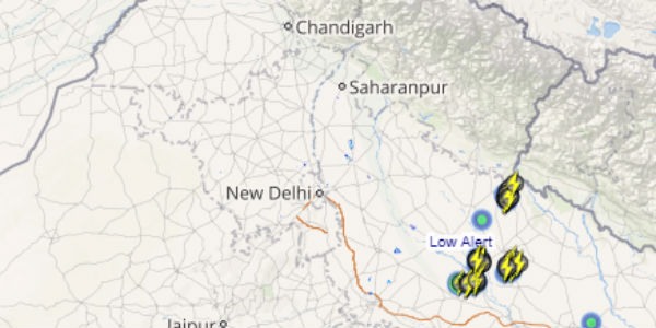
Many parts of Delhi and NCR region have received intense thundershowers in the last 24 hours. In a span of 24 hours from 08:30 am on Wednesday, Safdarjung observatory recorded 28 mm of rainfall, Ayanagar 24 mm, Ridge 15 mm. On the other hand, Palam observatory observed a mere of 2.4 mm of rain.
Few areas have also recorded heavy showers as well.
[yuzo_related]
These weather conditions could be attributed to the axis of Monsoon trough that was passing across Delhi until yesterday. Hence, the moisture incursion has increased, resulting in good rain and thundershowers across many parts of the national capital.
However now , the axis of Monsoon trough has moved north of Delhi and currently passes through Punjab, Haryana and Uttar Pradesh. Moreover, the humid easterly winds are likely to be replaced by dry westerly winds over the region.
Click the image above to see the live lightning and thunderstorm across Delhi
Weathermen predict the weather to remain partly cloudy to cloudy for the next 24 to 48 hours but we do not expect rain to show up over Delhi and NCR for at least next 3 to 4 days till the time axis of Monsoon trough remains north of Delhi.
However, with rise in temperatures and high humidity; isolated thundery clouds may develop during late afternoon or evening hours which may end giving light rain for short interval at one or two places.
IMAGE CREDIT: surya.com
Any information taken from here should be credited to skymetweather.com


