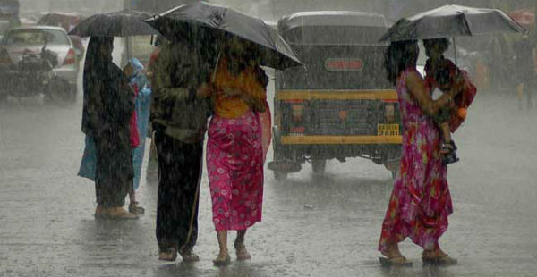
The last 24 hours, Central India has recorded light to moderate rainfall and thundershower activities. After a hot and dry weather conditions giving the residents of Central India the taste of the summer heat, we now have some weather activity in the store. With this, the mercury is most likely to shift gears.
As per Skymet Weather, a cyclonic circulation is seen persisting over southwestRajasthan. A trough is also seen extending up to Bangladesh acrossMadhya Pradesh, North Odisha, and Chhattisgarh.
Due to this trough, scattered thunderclouds had developed over Southwest Madhya Pradesh, Vidarbha, Chhattisgarh, and Odisha, leading to rain and thundershowers.
In fact, in span of last 24 hours from 8:30 am on Thursday, Rajkot recorded 70 mm of rainfall, Amraoti 34 mm, Sambalpur 30 mm, Mahableshwar 27 mm,Wardha22 mm,Bramhapuri17 mm, Indore 12 mm, Mount Abu 10 mm, Durg 6 mm, Raipur 4 mm and Mana 2 mm.
Thereafter, these pre-Monsoon weather activities will significantly increase and the weather conditions are likely to remain pleasant for the next few days. However, these weather activities are most likely to occur during the afternoon or late evening hours.
CHECK OUT THE LIVE LIGHTNING STATUS OVER CENTRAL INDIA:

These thundery clouds over Vidarbha, South Chhattisgarh, North Madhya Maharashtra and Gujarat are likely to persist. With this, we may expect light to moderate rain and thundershower activities to continue over these regions along with parts of Southwest Madhya Pradesh and southeast Rajasthan during the next 24 to 36 hours.
Until then, these on and off pre-Monsoon activities will help keep the temperatures under control and the prevailing heatwave conditions over Central India are not likely to make a comeback anytime soon. The onset of Monsoon 2017 is expected to arrive in these areas by Mid-June.
Image Credit: NDTV
Any information taken from here should be credited to skymetweather.com