On and off pre-Monsoon rains have been battering the easternmost state of West Bengal and its adjoining Odisha. However, the intensity of rains has been varying almost every other day.
On the past day also, most parts of West Bengal, including both Gangetic West Bengal and Sub-Himalayan West Bengal have recorded light to moderate rain and thundershower activities. Meanwhile, parts of North Coastal Odisha also recorded light to moderate with isolated heavy spells.
Within the span of 24 hours, from 08:30 am on Sunday, Chandbali recorded 59 mm of rains,Darjeeling50 mm, Paradip 29 mm, Contai 29 mm, Siliguri 28 mm,Kolkata24 mm,Diamond Harbour24 mm, Bankura 9 mm, Bagati 6 mm,Balasore5 mm, and Digha, Sri Niketan, Sundargarh, andSambalpurrecorded 3 mm of rains each.
[yuzo_related]
The reason for these rains, as per Skymet Weather can be attributed to the trough which is extending from North India to Nagaland across Gangetic West Bengal. In addition to this, moisture incursion from the Bay of Bengal is also taking place as a cyclonic circulation is seen over North Bay of Bengal.
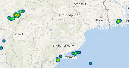
Click here to get the live lightning and thunderstorm status across West Bengal and Odisha
As of now, light to moderate rains with few heavy spells along with thunderstorms and lightning strikes are expected to continue in parts of Gangetic West Bengal and North Odisha. Thus, rains would continue to drench the stations likeParadip, Balasore, Chandbali,Burdwan, Diamond Harbour, and Kolkata.
The intensity of these rains is likely to reduce after 48 hours over parts of Gangetic West Bengal and Odisha. However, isolated rain and thundershowers would continue over these areas. On the other hand, scattered light to moderate pre-Monsoon rain and thundershowers would continue over Sub-Himalayan West Bengal over places like Coochbehar, Darjeeling, Bagdogra,Jalpaiguri, and Siliguri.
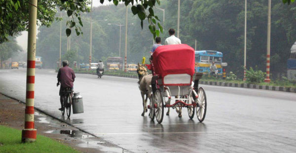
ImageCredit: Pinterest
Any information taken from here should be credited to skymetweather.com


