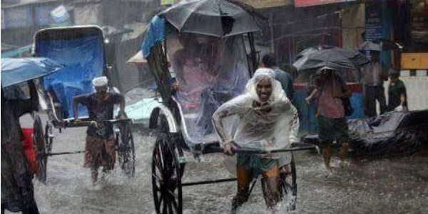
East India has been witnessing good pre Monsoon rains and thunderstorm activities for the past many days. In the past day also, states of Odisha, Jharkhand, West Bengal and Chhattisgarh recorded light to moderate pre Monsoon rains with isolated heavy spells along with strong winds and lightning strikes.
[yuzo_related]
In the last 24 hours from 8:30 am on Saturday, Bankura recorded rain to the tune of 39 mm, Shanti Niketan 27 mm, Balasore 26 mm, Digha 25 mm, Jamshedpur 18 mm, Diamond Harbour 8 mm, Bhubaneswar 7 mm and Puri 4 mm rains. In the same time frame, the city of joy Kolkata recorded light rain to the tune of 3 mm.
As per Skymet Weather, a cyclonic circulation lies over Jharkhand and adjoining regions. In association with this system another cyclonic circulation is prevailing over Gangetic West Bengal and adjoining Bangladesh. In fact, an anti-cyclonic circulation also prevails over Northwest Bay of Bengal. This system is feeding moisture to the above-mentioned weather systems.
In wake of these combined weather phenomena’s, light to moderate rain with isolated heavy showers and thunderstorm activity will continue to occur over Odisha, Jharkhand, West Bengal, and Chhattisgarh during the next 36 hours also. In fact, along with these pre Monsoon rains, violent thunderstorms also termed as ‘Kal Baisakhi’ or Nor'westers would occur over these regions.
Districts such as Balasore, Koraput, Bhubaneswar, Jamshedpur, Ranchi, Bankura, Bokaro, Purulia, Malda, and Kolkata are expected to witness Pre Monsoon activities.
Weather during the day would be mainly warm and moist as these pre Monsoon rains would appear most during the afternoon and late evening hours.
IMAGE CREDIT: Mapsofindia
Any information taken from here should be credited to skymetweather.com


