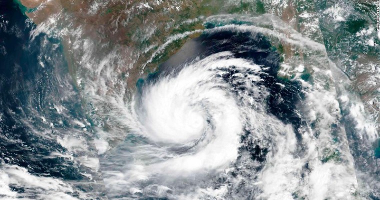
Bay of Bengal (BoB) is warmer than the Arabian Sea and therefore is a hotspot of cyclones. Due to lower sea surface temperature (SST) and unfavorable wind shear, high intensity cyclones were relatively less frequent in the Arabian Sea (AS) than in BoB. Atmospheric dynamics are different for the Indian Seas on either side of coastline. In the Arabian Sea, winds associated with the pre monsoon and summer monsoon season are stronger and favor the transfer of heat to deeper layers owing to overturning and turbulent mixing. However, researchers believe, the Arabian Sea has been warming faster, attributable to global warming. Warming in the deeper layers is increasing the ‘Ocean Heat Content’. There is a strong linkage between the accelerated warming of the Arabian Sea and frequency and intensity of cyclones over that region. Year 2019 holds record of 9 cyclones in the Indian Seas and major share of 6 storms go to the Arabian Sea. Also, 3 of these storms formed in the 1st half of the year and 6 in the latter part. There were aberrations of having storms in the southwest monsoon, one each in June( (Vayu) and September (Hikaa).
During the current season, BoB continue to retain its status of ‘hotspot’ for the tropical cyclones. Exception was made with a tropical storm 01B emerging in the 1st week of March itself. Yet another weather system, albeit a grade lower than the storm, appeared in the 3rd week. The deep depression, as expected, spared the Indian coastline and struck Myanmar. This basin remains active and may possibly churn another storm during 1st half of April.
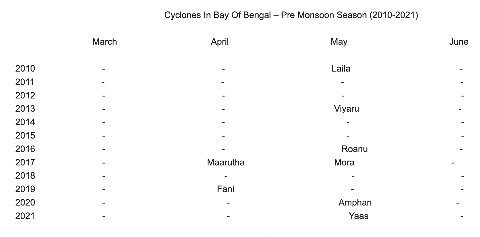
March to May is considered as the pre monsoon season, favorite for cyclones, for the Indian sub continent. As the southwest monsoon does not advance over central and northern parts of BoB and Arabian Sea, till middle of June, tropical storms are not very rare during June. Howsoever favorable environmental conditions may stand, BoB has not witnessed more than 2 cyclones in the entire season. Since 2010, a total of 8 storms have developed between March and June over this basin. Not even a single storm formed during 5 of these years ( 2011,2012, 2014, 2015, 2018) between Mar-June. Year 2017 was the only exception of hosting 2 storms ( Maarutha & Mora), one each in April and May.

It is quite evident that storms form more frequently in the month of May over BoB, in the pre monsoon season. March and June did not see a storm during 2010-2021. Also, it may be inferred that frequency of a Super Cyclone ( Amphan) and Extremely Severe Cyclonic Storm (Fani) is about 1 in 10 years.
Global warming is enhancing the heat content of the oceans across the board. Most important parameter for initiation and sustenance of oceanic disturbance is the SST. Temperature in excess of 26°C remains the most desired condition. Increase of just 1°C of SST will amount to exponential rise of heat potential. Apparently, Bay of Bengal seems to be slightly warmer than the average at this point of time. Increase in number of weather systems is a testimony of amplification of heat content. Probability of having cyclonic storm in April over Bay of Bengal is quite high. Month of May being as such a favorite for storms, pre monsoon season 2022 looks all set to become an outlier. Quite possible to find a storm in each month over the active basin of Bay of Bengal.


