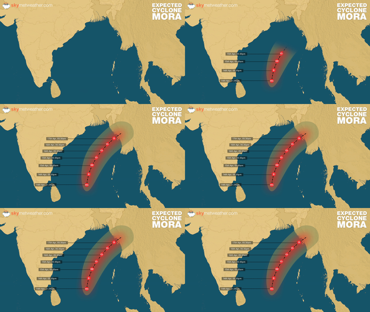
 The depression in Bay of Bengal has intensified into deep depression. It will continue to get more marked and conditions remain favourable for its further intensification into a cyclonic storm during the next 12 hours. If this happens, it will be the maiden cyclone of the season in Bay of Bengal and will be named as ‘Cyclone Mora’.
However, the system is likely to escape the East Coast of India that includes Tamil Nadu, Andhra Pradesh and Odisha. The depression has been moving north-northeastwards and is likely to continue to move in the similar direction towards the coast of Myanmar.
Also Read: Well marked low pressure is now a depression, cyclone in next 24 hours
At present, system is seen over east-central and adjoining southeast Bay of Bengal, moving at a speed of 28 kmph. According to Skymet Weather, cloud configuration and atmospheric conditions are conducive for system to induce into a deep depression during the next 24 hours and turn into a cyclonic storm in subsequent 24 hours.
But, weathermen are expecting that at the time of making landfall it would downgrade to deep depression or depression only. The weather system is likely to cross Myanmar coast between Sittwe and Sandway by forenoon of April 17.
Though any rains are ruled out over the Indian East Coast but partly cloudy sky cannot be ruled out. However, Andaman and Nicobar Islands may record rainfall over most parts, with heavy rains at few places. Squally winds with the speed of 50-60 kmph gusting up to 70 kmph are also expected during next 48 hours.
Sea conditions would be very rough along and off Andaman Islands during the next 2 days. Fishermen are advised not to venture into sea along and off Andaman Islands during next 48 hrs.
Northeastern states of Nagaland, Manipur, Mizoram and Tripura could also witness some good rain and thundershowers during the next 2-3 days.
Image credit: wikipedia.org
Any information taken from here should be credited to skymetweather.com


