Until May 16, the Southern Peninsula is running rain deficient by 46%. The regions of Tamil Nadu, Puducherry and Lakshadweep are running rain deficient by a large margin. The remaining meteorological divisions of South India are also running deficient. So, we can state that the pre-Monsoon activities have remained scanty over the Southern Peninsula till now.
Since the last few days, rainfall activity has increased in interior Tamil Nadu, South Interior Karnataka and parts of Kerala. Isolated rain has also been witnessed over coastal Andhra Pradesh, Rayalaseema and Telangana. These pre-Monsoon activities however remained light to moderate and highly localized. Although one or two heavy spells were witnessed but they failed to bring down the rainfall deficiency in South India.
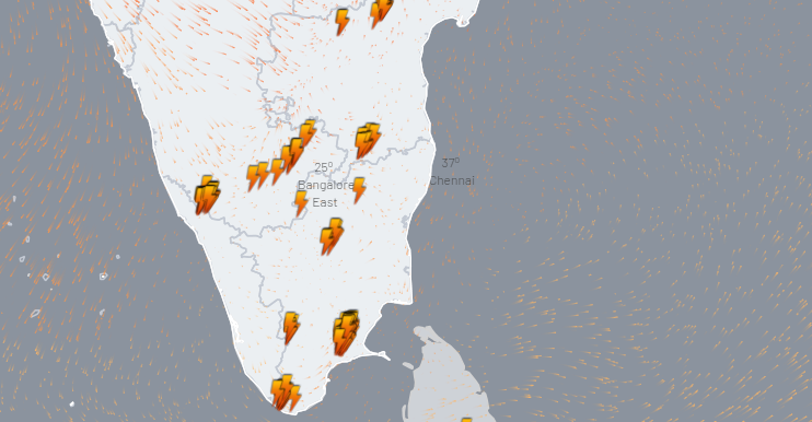
Lightning seen over different parts of Kerala, Karnataka and Tamil Nadu:

Click here to check the live lightning and thunderstorm status across the country
Now, a Cyclonic Circulation is seen over South Interior Karnataka and a trough is extending across Comorin area and Tamil Nadu which may enhance the rains over Interior Tamil Nadu, South Interior Karnataka as well as Kerala. But we do not expect heavy rains in these areas. Rains will mainly remain patchy and localized.
These pre-Monsoon activities are expected to continue with variation in intensity throughout the month of May until the onset of Monsoon. Rain intensity may pick up over South Tamil Nadu and Kerala during the last week of May and initial phase of June just before the onset of Monsoon. But we don’t expect any significant rainfall activity over Telangana, North Interior Karnataka or Andhra Pradesh in the coming days. Therefore, the weather will remain hot, humid and uneasy in the region for some time.
Image Credits – Point of view
Any information taken from here should be credited to Skymet Weather


