The western Pacific sees more tropical storms and typhoons each year than any other oceanic basin. The year 2019 saw a very active season with a total of 29 storms, 17 of them being typhoons and four intensifying to the super typhoons. The season's first typhoon, Wutip reached typhoon status on Feb 20, 2019. The last of the storm, Phanfone dissipated on Dec 29, 2019. The 2019 Pacific typhoon season was the costliest on record,just ahead of the previous year. Most tropical cyclones typically develop between May and October, however, there are no official bounds as such for these storms.
The season's first named storm Pabuk formed on Jan 01, becoming the earliest forming tropical storm of the western Pacific Ocean on record, breaking the previous record held by typhoon Alice in 1979. This system later entered the Bay of Bengal as a weak storm and dissipated later over the sea itself.
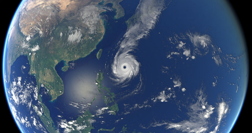
The season's first typhoon Wutip reached typhoon status on Feb 20, and later intensified to a super typhoon, becoming the strongest February tropical cyclone on record in the Northern Hemisphere.
Unlike thehurricane seasonof the Atlantic Ocean, the forecast of typhoons in the West Pacific basin is not that exhaustive.
There are several National Meteorological Services and scientific agencies to forecast the number of tropical storms and typhoons forming during the season and how many of them will affect a country in the western Pacific rim. These include PAGASA (Consortium of University College London) and Taiwan's Central Weather Bureau. The first forecast for the year was released by PAGASA on Jan 22, predicting 0-4 tropical cyclones from January to March, while 5-8 tropical cyclones are expected from April to June. The neutral ENSO conditions in the Pacific was the mainstay of this forecast. No storms have developed in the Pacific basin so far during this season.
A storm is named when the weather system achieves sustained wind speed of 65 km/h. The tropical storm qualifies to the category of a typhoon on attaining a wind speed of 118 km/h. West pacific basin has a very strong connection with the IndianSouthwest Monsoon. These storms and typhoons do influence the intensity of monsoon current and therefore rainfall, especially over Peninsular India. Few of these storms do enter the Bay of Bengal or the Andaman Sea as a weak system and accelerate the surge to enhance the rainfall.


