

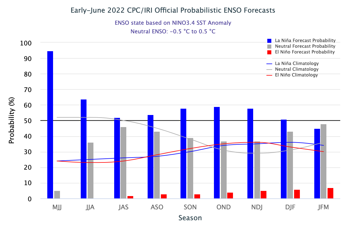
Equatorial sea surface temperatures (SSTs) are below the average across most of the Pacific Ocean. Key oceanic and atmospheric variables have remained consistent with La Nina conditions. ENSO outlook suggests the continuation of the La Nina event with a >60% chance during June – August 2022.
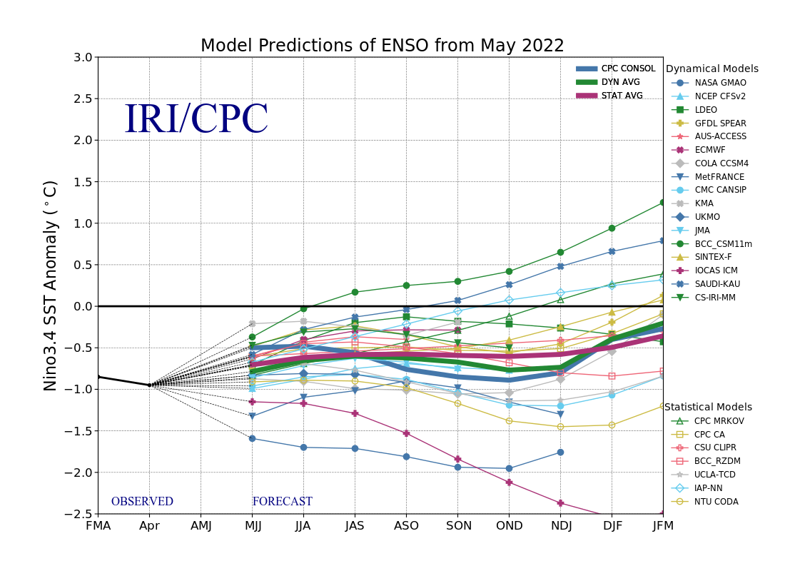
ENSO: ENSO forecast is based on a set of dynamic and statistical models. As the skills of these models are not equal to one another, an ensemble forecast gives judicious weightage to each one. Also, the skills generally decrease as the lead time increases. Even, the skill score of these models varies at different times of the year. Forecasts made between June – December have an edge over the others made between February – May.
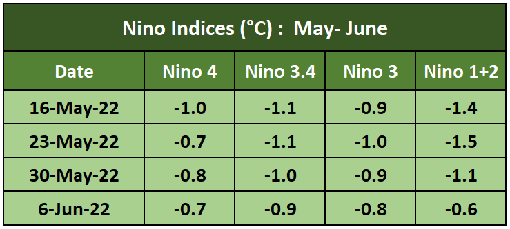
All four Nino Indices have marginally decreased as compared to the last 2 weeks. However, the indices continue to remain below the threshold mark of - 0.5°C. Equatorial Central Pacific is cooler than the flanks on either side.
La Nina is expected to weaken slowly but persists through the Northern Hemisphere summer and into early winter 2022-23.
Indian Ocean Dipole: Sustained sea surface temperature gradient between tropical western and eastern Indian Ocean is termed IOD. This gradient is also called Dipole Mode Index (DMI). When DMI is -ve, the phenomenon is referred to as -ve IOD. The IOD is currently neutral. The index has been below zero for the last 4 weeks with its lowest -ve value of -0.55°C on 23rd May. IOD as such has remained below 0°C for the last 12 months, except briefly rising above 0°C during the 1st week of May 2022. For an IOD event, these values need to be sustained for 8 weeks.
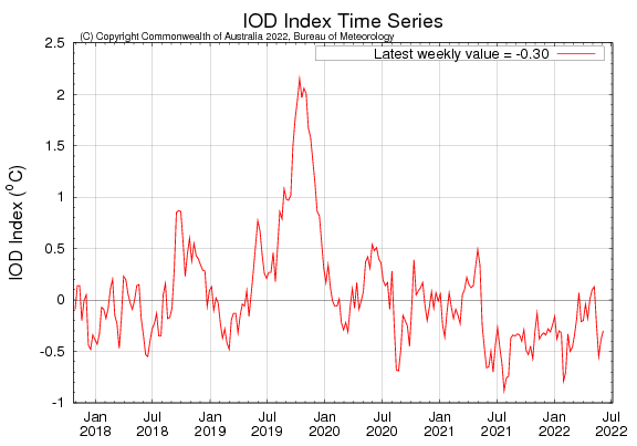
The latest IOD index value for the week ending 06 June 2022 was -0.30°C. Most climate models have a consensus of -ve IOD events coming up over the monsoon months. The accuracy of the IOD forecast increases from June onward.
Madden Julian Oscillation: The presence of MJO can induce intra-seasonal variability of wind and pressure in the atmosphere. This can significantly impact surface and sub-surface conditions across the Pacific Ocean. The MJO is currently at moderate strength over the Western Hemisphere. MJO is expected to strengthen and increase its amplitude during the week 14-21 June. MJO will be positioned in phase-1, in close proximity to the Indian Ocean. This could be beneficial for activating the monsoon stream across the Arabian Sea. However, this will lead to the strengthening of westerly wind anomalies over the equatorial belt in the Western Pacific, which typically act to weaken La Nina conditions.

Southwest Monsoon has commenced its journey over the Indian sub-continent, albeit on a weaker note. Intensity is mild and progress is sluggish, despite before-time arrival as announced by the National Weather Agency. Arabian Sea branch was stuck for nearly 10 days, before advancing over Goa, more parts of Maharashtra, Karnataka, Tamil Nadu, and Andhra Pradesh.
