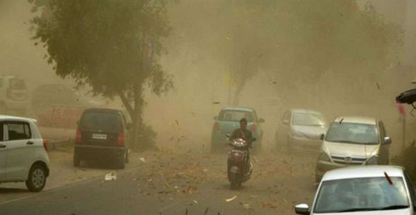
The northwestern plains of India that includes Punjab, Haryana, Delhi, North Rajasthan and West Uttar Pradesh are all set to witness first spell of scattered and widespread dust storm activity accompanied with thundershowers in few pockets.
The plains of Northwest India have been witnessing pleasant weather conditions since March. It was only during the fag end of the month that the maximum temperatures in some pockets rose to touch 39˚C. But again, since the beginning of April, the northwestern plains are witnessing day temperatures in mid-30’s.
Currently, pre-Monsoon season is going on due to which dry weather conditions along with moisture trigger dust storm activities in parts of the country. Therefore, in the coming days because of the accumulated heat and moisture content, dust storm activity is expected to commence right from western parts of Rajasthan gradually moving up to parts of Northwest India.
In fact, a fresh Western Disturbance will affect the Western Himalayas on April 4. This system will induce a cyclonic circulation over parts of West Rajasthan. This will result in isolated thundershower activities in parts of Punjab, Haryana, Delhi, Rajasthan and Uttar Pradesh.
During the time of dust storm the AQI levels increase thus, we expect the pollution levels in Delhi and NCR to come under poor to very poor category. The high velocity winds during the time of dust storm may also become harmful for the crops in Punjab, Haryana and Uttar Pradesh.
Image Credit: Wikipedia
Please Note: Any information picked from here must be attributed to skymetweather.com


