Since about two months, absolutely dry weather conditions have been prevailing over entire Northwest India. A few feeble Western Disturbances travelled across Jammu and Kashmir, however, they failed to give any weather activity over Northwest India.
As winter is approaching, minimum temperatures are witnessing a decrease during the last few days. High humidity, low temperatures along with light winds have resulted in the formation of fog. Thus, the plains of North India have been witnessing dense fog during the morning hours. Not only this, mainly due to stubble burning across Punjab and Haryana, many parts have also been observing smoggy conditions with rising pollution levels.
[yuzo_related]
Now, an active Western Disturbance is expected to approach the Northern Hills during the next few days. Thus, the hilly states will witness rain and thundershowers during this time period.
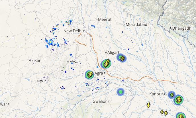
This system is likely to induce a cyclonic circulation over Haryana and Punjab. Due to this induced weather system, rainfall activity is expected to make an appearance over some parts of Punjab, Haryana as well as isolated pockets of North Rajasthan.
Check out the live lightning and thunderstorm status across North India
Due to these rains, temperatures will also witness a drop in many regions and there will be reduction in fog conditions as well.
These rain activities are also likely to wash away the pollutants over those areas. Thus, after the passage of Western Disturbance, the winds which will travel towards the Northern Plains will be much cleaner and will help in reduction of ongoing pollution levels.
Image Credit: India.com
Please Note: Any information picked from here must be attributed to skymetweather.com


