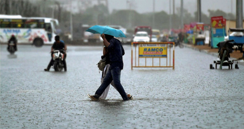
Chennai continues to record heavy to very heavy rains for the third consecutive day on Sunday. In span of 24 hours from 8:30 am on Sunday, Nungambakkam Observatory has recorded 45 mm of rains. In fact, entire state ofTamil Naduhas recorded widespread heavy rains.
These ongoing spell of rains have wreaked havoc, with large parts being flooded. These unabated rains for last two-three days have claimed 17 lives so far. In view of heavy rains warning, schools and colleges are shut inChennai, Tuticorin, Tiruvallur and Kancheepuram.
These rains can be attributed to active Northeast Monsoon conditions on account of an easterly wave over Southwest region off the Sri Lanka and Tamil Nadu coast. Along with this, a low pressure area has also formed and is marked over Lakshadweep region and adjoining Southeast Arabian Sea. This has further strengthened the easterly waves, thus enhancing the Monsoon rains over entire Tamil Nadu including Chennai.
At present also, intense clouding is seen over Chennai and nearby areas. Weathermen predict moderate rains with few heavy spells to continue today as well. However, we now expect these rains to start reducing.
As per the forecasters, the easterly wave would be now moving westwards and the low pressure area would also be moving north-northwestwards. Thus, rains would now start receding in Chennai Monday onwards. However, South Tamil Nadu would continue with good rains.
In span of two days, Chennai has already recorded 104 mm against the monthly average of 177 mm. With more rains in offing, we expect Chennai to get more closer to its monthly target.
However, city had failed to record its monthly average rainfall during its rainiest month of November due to subdued Northeast Monsoon surge. The Nungambakkam Observatory recorded mere 102 mm of rains compared to monthly mean of 374.4 mm, while Minambakkam Observatory saw 223 mm of rains.
Chennai records more than 60% of its annual rainfall during the three-month long Northeast Monsoon season. November rainiest month, followed by October and then December. Being the retreating month, the quantum of rainfall drops considerably in December.
Image Credit: NDTV
Any information taken from here should be credited to skymetweather.com


