

The state of Uttar Pradesh has not been very lucky this Monsoon season. Firstly, Monsoon made a delayed arrival over the state and then the pocket did not saw many rainy occasions during the initial days, leaving a large deficit across the entire state.
However, for the last couple of days, the state has been recording moderate to heavy rains that have even triggered an alarming situation for flood or waterlogging in parts. On the last day as well, moderate to heavy with isolated three-digit rains were reported in the state.
In the last 24 hours, from 08:30 am on Tuesday, Bareilly recorded three-digit rains to the tune of 103 mm, followed byLucknowat 95 mm, Fursatganj 77 mm,Allahabad41 mm, Hardoi 37 mm, Sultanpur 35 mm,Kanpur26 mm, Bahraich 21 mm, Banda 19 mm, Hamirpur 19 mm,Agra18 mm, Jhansi 17 mm, and Gorakhpur recorded 3 mm of rains.
[yuzo_related]
In the wake of these rains, the rainfall deficiency of both the divisions, East and West Uttar Pradesh has improved drastically. Initially, both the regions were largely deficit by more than 50%. However, as of July 31, West Uttar Pradesh has become rain surplus by 8% meanwhile, East Uttar Pradesh is rain deficient by 19%.
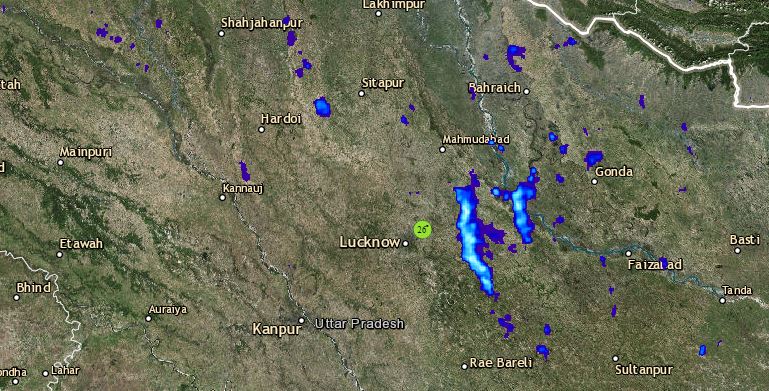
Click here to get the live lightning and thunderstorm status across Uttar Pradesh
As per Skymet Weather, as of now also the low-pressure area is still over Central Uttar Pradesh. A trough is also extending from Punjab to Bihar across East Uttar Pradesh. Therefore, we expect moderate to heavy showers to continue over both East and Central districts of Uttar Pradesh for another 24 to 48 hours. Thus, it may deteriorate the issues pertaining to waterlogging further.
However, rains are now likely to reduce over the western parts of the state significantly. After 48 hours, rains will reduce over the entire state as the axis of Monsoon trough would shift north, towards the foothills of Himalayas.
Image Credit: Wikipedia
Any information taken from here should be credited to skymetweather.com


