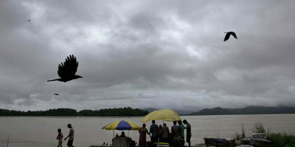
The last day was no lesser than a miracle for the southern states of Telangana and Andhra Pradesh that got to witness some light to moderate rains after an elongated dry spell. In fact, the month of March was also a dry period for both the states with light spells showing up only on one or two occasions during min-March.
The weather was dry after which it was the last day when some showers appeared. However, now, the rain activity over parts of Telangana and Andhra Pradesh are expected to reduce again.
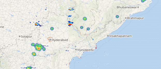
As per Skymet Weather, a trough from West Bengal to Tamil Nadu was running across Telangana. Moreover, moisture incursion from the Bay of Bengal was also taking place. Both these weather systems can be held responsible for the good rains accompanied with hailstorms in parts over Telangana.
Parts of Andhra Pradesh, mainly the coastal stations also recorded rainfall activities due to the same weather systems. However, the interior regions of Andhra Pradesh also witnessed some scattered rain activities.
[yuzo_related]
Short spell rain and thundershower with strong gusty wind may occur at some parts over Anantapur,Chittoor, Kadapa, Kurnool,Nellore, Prakasam, East Godavari, Guntur,Krishnaand West Godavari districts of Andhra Pradesh during next 4 to 6 hours.
Rain and thundershower with squally winds are expected at some places overHyderabad, Mahbubnagar, Medak,Nalgondaand Ranga Reddi districts of Telangana during next 2-4 hours.
Click here to get the live lightning and thunderstorm status across Andhra Pradesh and Telangana
Now, Skymet Weather anticipates that as this trough is expected to start weakening and shift towards the east, therefore, rain over Telangana would reduce. However, isolated thunderstorm may continue over parts of the youngest state of the country for another 24 hours.
Similarly, the rain intensity over Andhra Pradesh would also reduce but scattered rain and thundershowers would keep going on for the next 24-48 hours over the stations lying along the coastal belt of the state. Whereas, Rayalaseema may also get isolated rain and thundershower activities for another 24-48 hours. Thereafter, the weather would become dry over both the states.
ImageCredit: Evening Standard
Any information taken from here should be credited to skymetweather.com


