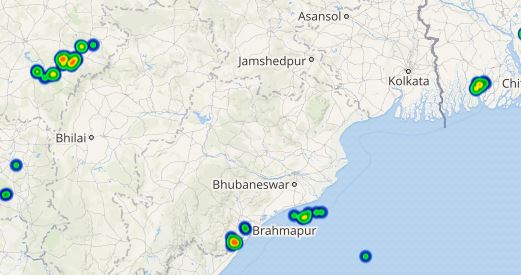
Odisha has been receiving rain and thundershower activities since the beginning of pre-Monsoon season, although these activities remained mainly confined to the northern coastal parts of the state.
During the last 24 hours also, few good spells occurred over the northern parts of Odisha. In the last 24 hours, from 08:30 am on Tuesday, Balasore recorded hefty rains of 46 mm, followed by Cuttack at 33 mm, Baripada 17 mm and Jharsuguda witnessed 8 mm of rains. Meanwhile, Chandbali, Paradip and Sundargarh recorded 2 mm of rains each.
In the wake of these rains, the temperatures have dropped significantly in most parts in the last 24 hours.
[yuzo_related]
As per Skymet Weather, these rains can be associated with the trough extending from Sub-Himalayan West Bengal to Interior Odisha. Due to this trough, moisture incursion is taking place, thereby resulting in cloud formation and then rains.
Click here to get the live lightning and thunderstorm status across Odisha
As of now, conditions are favorable for light to moderate rains to continue over Odisha, mainly over the north coastal areas for the next 24 hours.
Thereafter, the intensity of these showers would reduce but isolated activities would continue. Due to the reduction in the rain activities, we expect a gradual rise in the temperatures after 24 hours.
Image Credit: Wikipedia
Any information taken from here should be credited to skymetweather.com


