Southwest Monsoon has reached nearly the Maldives-Comorin region, Sri Lanka and southern and eastern parts of the Bay of Bengal. Cyclone Yaas expedited the advance of monsoon over these parts and the next stop is mainland India anytime soon. Monsoon countdown starts amidst a change of guard over the Pacific Ocean. A La Nina advisory is no longer in effect and ENSO neutral conditions are present.
In mid-May, sea surface temperatures in the East-Central Pacific are roughly 0.3 degrees centigrade below average. These fall within the neutral range and suggest the exit of La Nina. The key atmospheric variables are consistent with the end of La Nina conditions. ENSO neutral is likely to persist through at least July-Aug-Sep, albeit with a mild spike of La Nina component halfway through the season. An important indication of the Pacific Ocean not warming through the monsoon season is a relief and its slightly cooler state promises decent rains.

The Nino indices continue to show marginal changes and mostly remain below 0 degrees celsius. The status quo is being maintained for the last about 4 weeks. These are expected to behave and retain this trend in the onset phase of the monsoon. Nino 3.4, the principal measure for assessing, monitoring, and predicting ENSO has been consistent though marginal decline over the last 4 weeks.

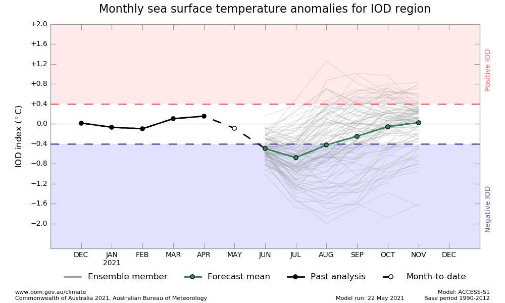
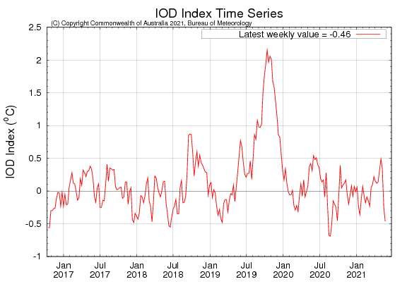
As expected, fluctuations in the IOD (Indian Ocean Dipole) continue and are expected to settle down within the next few weeks. IOD is defined by the difference in sea surface temperature between the eastern and western tropical Indian Ocean.

The IOD West is measured between 50-70 degrees east and 10degree south to 10degree north and IOD East is recorded between 90-110degree east and 0-10 degrees south. The IOD is currently neutral. The latest value for the week ending 23 May is -0.46 degrees celsius.

Model accuracy is generally lower at this time of the year than at other times. These are to be considered with caution for the long-term outlook.


