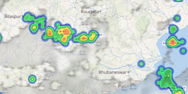
North Chhattisgarh and parts of Odisha have been witnessing light to moderate rains during the last few days. In fact, the last 24 hours were also not too different and the region did witness a few good spells of rainfall activity.
[yuzo_related]
In a span of 24 hours from 8:30 am on Monday, Jharsuguda recorded a good 36.3 mm of rainfall followed by 30.3 mm of rain in Ambikapur. Other areas to have recorded good showers include Bhawanipatna 16.6 mm, Keonjhargarh 18 mm, Chandbali 13 mm, Balasore 14.4 mm, Koraput 8 mm, and Raipur 5.1 mm.
These weather conditions are attributed to the presence of the well-marked low over Gangetic West Bengal and adjoining Jharkhand. Now, the well-marked low pressure area will move in northwest direction away from the state of Odisha and Chhattisgarh, thereby weakening to a low pressure area.
Check out the latest lightning and thunderstorm status across Odisha and Chhattisgarh
Thus, we expect rainfall activity to witness a fall gradually. However, light to moderate showers will continue over many parts of North and Interior Odisha as well as north and central areas of Chhattisgarh.
By July 27, rains will reduce significantly over these states as the weather system will weaken further. In fact, cities including Ambikapur, Bhubaneswar, Raipur, and Jharsuguda will witness reduced rain activity. But, scattered showers are expected to continue even after July 27. However, intensity and spread will reduce significantly and only short spells of rains will be recorded and continuous rains will take a backseat.
Image credit: india.com
Any information taken from here should be credited to skymetweather.com


