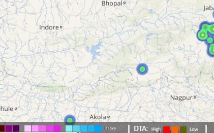
Most districts of Madhya Pradesh have been observing occasional showers from the last couple of days. In fact, sparing a few couple of days, on and off showers have become a scene to spectate for most parts of the state.
Rains varying from light to moderate intensity have even occurred over north and west regions of the state. The last 24 hours were rainier too for most districts of Madhya Pradesh. In the last 24 hours, from 08:30 am on Monday, Seoni witnessed 47 mm of rains, Shajapur 31 mm, Guna 30 mm, Bhopal 17 mm, Satna 17.3 mm, Hoshangabad 15 mm and Chhindwara recorded 14 mm of rains.
Click the image above to see the live lightning and thunderstorm across Madhya Pradesh
As per Skymet Weather, these rains can be attributed to a trough that is passing from West Rajasthan to the Bay of Bengal across Madhya Pradesh. Moreover, the cyclonic circulation which is over Chhattisgarh and Odisha is also moving in a northwest direction thereby leading to an increase in rains over Madhya Pradesh.
[yuzo_related]
Additionally, Southwest Monsoon is also progressing at a fast pace and has further advanced and covered some more regions in Madhya Pradesh. Furthermore, it is expected that it may cover almost the entire state in the next 48 hours. The amalgamation of the progress of Southwest Monsoon along with the aforesaid weather systems, rains are likely to increase now over parts of the state.
On account of these rains, the rainfall statistics of the state will also improve. West Madhya Pradesh which as on June 27 is 16% rain surplus will increase further. On the other hand, East Madhya Pradesh which is 36% rain deficient as on the above-mentioned date will crawl back towards normal.
Hence, in the next 24-48 hours, light to moderate rains with one or two heavy spells are likely to continue over the state for the next few days. In a nutshell, people in Madhya Pradesh may brace for a rainy week ahead.
Image Credit: India.com
Any information taken from here should be credited to skymetweather.com


