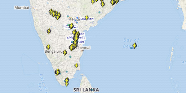
The month of September seems to be quite good in trems of precipitation for most of the southern states. Rain and thundershowers activities of varying intensity have been pounding many regions such as Karnataka, Kerala and Lakshadweep Islands.
During the same time, the states in North and Central India have been reeling under almost dry weather conditions.
[yuzo_related]
The past 24 hours were also of not much difference and Karnataka, Kerala and Lakshadweep Islands have recorded some extremely good Monsoon showers.
The reason for these rain and thundershowers can be attributed to the persistence of a north-south trough that extends across South interior Karnataka up to Tamil Nadu. Moreover, a cyclonic circulation was over Lakshadweep region and another circulation was over east-central Arabian Sea off Karnataka Coast.
In the last 24 hours from 08:30 am on Thursday, Kalaburgi recorded heavy intensity rains of 82 mm, Thiruvananthapuram 66 mm, Vijayapura 51 mm, Minicoy 43 mm, Kottayma 38 mm, Amini Divi 28 mm, Ballari 25 mm, Alappuzha 18 mm, Agumbe 17 mm, Balagavi 16 mm, Raichur 14 mm and Madikeri 11 mm.
Weathermen at Skymet Weather expect interior parts of Karnataka and most of Kerala to continue recording good rain and thundershowers for the next two days. Whereas, rains over Lakshadweep Islands will now decrease.
Click the image above to see the live lightning and thunderstorm across India
The states of Kerala as well as Karnataka is likely to continue witnessing rains till end of the month. The rain intensity may vary but prolonged dry spell is not likely.
Until date, Kerala is rain deficit by 20 percent, Karnataka by 15 percent, while Lakshadweep Islands are rain surplus by 11 percent.
IMAGE CREDIT: youtube.com
Any information taken from here should be credited to skymetweather.com


