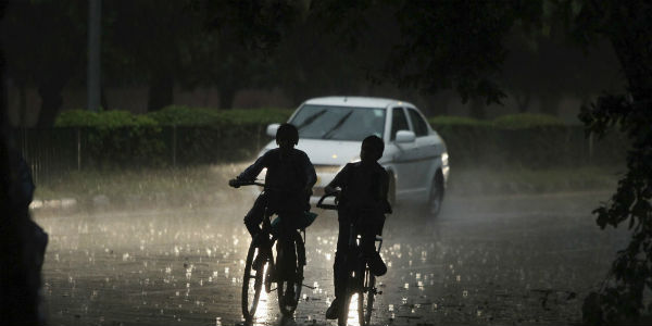
As predicted by Skymet Weather, Mumbai Monsoon has finally arrived. Monsoon 2018 has now covered most parts of Konkan, some more parts of Madhya Maharashtra, Marathwada and Vidarbha.
[yuzo_related]
In wake of this, heavy to extremely heavy rains occurred over South Konkan & Goa during the last 24 hours, while moderate to heavy rains occurred over Vidarbha and North Konkan including the state capital, Mumbai.
The maximum city received moderate to heavy showers at many places. Nariman Point Observatory saw 100 mm of rains last night, followed by Mulund at 60 mm. Meanwhile, Santa Cruz observatory recorded 37 mm of rains and Colaba 38 mm.
In the last 24 hours, Vengurla recorded extremely heavy rainfall activity to the tune of 266 mm, followed by Harnai 104 mm, Ratnagiri 102.4 mm, Alibagh 50.1 mm, Ahmednagar 27.2 mm, Akola 19.9 mm, Amravati 8 mm, Chandrapur 11.2 mm, Mahabaleshwar 6.4 mm, Nanded 9.5 mm, Osmanabad 24.8 mm, Parbhani 33.6 mm, Pune 5.4 mm, Satara 9.3 mm and Kolhapur 3 mm.
Currently, an off trough is running along the West Coast from Maharashtra Coast to Kerala and another trough is running from East Uttar Pradesh to Telangana across Vidarbha.
Therefore, we expect moderate to heavy showers over Vidarbha, parts of Marathwada and many parts of Konkan & Goa including Mumbai for the next 24 hours.
At present also, Mumbai has been recording moderate to heavy showers since Saturday morning. Places like Mahim and Hindmata are some of the worst affected areas.
Monsoon has brought city to halt, with several flights have been either delayed or cancelled. Local trains have also been running behind the schedule. Local authorities have been advising people to exercise caution.
Three teams of National Disaster Response Force (NDRF) are also on standby. Schools have also been kept open so that they can be used as shelter camps if needed.
Image Credit: Rains in Mumbai
Any information taken from here should be credited to skymetweather.com


