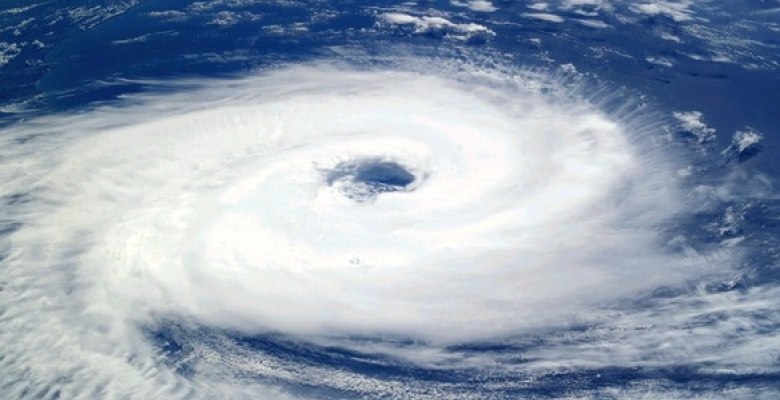
As anticipated by Skymet, the first cyclone of this year is likely to form shortly over Southeast Arabian Sea. Presently a feeble vortex is marked over the same area and in the subsequent 24 hours, a low-pressure area is expected to form over the Lakshadweep region and Southeast Arabian Sea. This weather system will intensify rapidly to a depression on 15th May and deep depression later within 12 hours. It is very likely to intensify in to a cyclonic storm (named Tauktae by Myanmar), the first of this season.
There are sufficient reasons for the weather system to intensify in to a cyclonic storm. MJO (Madden Julian Oscillation) is moving into phase 2 with sufficient amplitude to start with and this will enhance the convective activity over the Arabian Sea for the next few days. SSTs (Sea Surface Temperature) over this part of the Arabian Sea are in excess of 30 degrees celsius and are providing adequate heat potential for the growth of the system. Environmental conditions including the vertical wind shear and cross equatorial flow are likely to become better in the next few days and support the strengthening of cyclogenesis.

There is certain ambiguity among the various numerical models regarding track of this storm. It may come very close to Kerala and Karnataka coast or may steer towards central parts of the ocean. Though the storms do not travel along the coast and prefer venturing deep in to the ocean but they are also known for defying timelines and route. The clarity needs another 48 hours and the track, as well as intensity, will become predictable with precision.
No storm has formed during the last 10 years in the month of May over the Arabian Sea which tracked closer to the coast. Cyclone 'Phet' was the last storm in May 2010 (May 30 - June 07) that traveled over the deep ocean and finally came sufficiently close to Sind and Kutch region. Ultimately it fizzled out over the sea itself. However, the Bay of Bengal has the past record of hosting cyclones in May which threatened the Indian coastline. Cyclone Viyaru in 2013 and more closely cyclone Roanu came dangerously close all along the East Coast but finally struck Bangladesh.
Storm formation at this point of time is consequential for the advance of the monsoon stream over the Indian waters. Irrespective of its track, the storm will clear from our area of interest latest by 21st May. Still sufficient time to recover and re-establish the normal pattern to welcome the southwest monsoon without inordinate delay.


