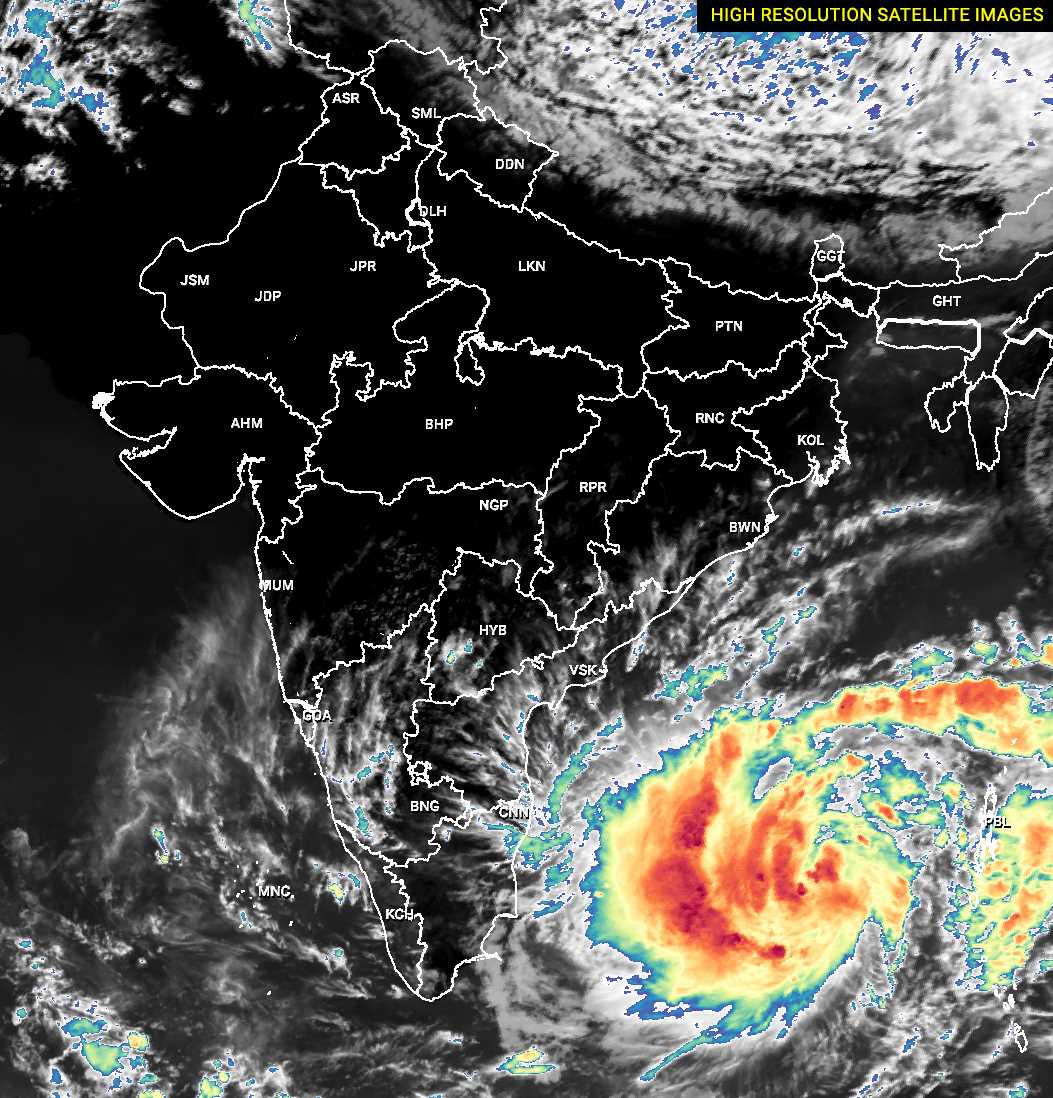
The deep depression over the Southeast Bay of Bengal (BoB) intensified into a tropical storm Mocha. Cyclone Mocha was centred around 11.1 Degree North and 88.2 Degree East at 0530am today morning. The storm is located approximately 500 km west-southwest of Port Blair. The weather system is moving at a speed of about 10kmph.
Cyclone Mocha is moving more northward and will follow this track for another 24 hours. During this period, the cyclone is likely to intensify further to a severe cyclonic storm tonight and further to a very severe cyclonic storm, equivalent to a Cat-II hurricane, by tomorrow morning. The wind field of the storm will have gusts in excess of 150 kmph. From hereon, the cyclone will start recurving and moving northeastward. Storm Mocha will head for landfall over border areas of Bangladesh and Myanmar. It is expected to strike anywhere between Cox's Bazar (Bangladesh) and Kyaukpyu (Myanmar) on the 14th Morning.
Storm Mocha may weaken a little before making landfall because of entrainment, friction and lower sea surface temperatures. Despite this, the cyclone is expected to make landfall as a very severe cyclonic storm with wind speed in excess of 120 kmh and gusting to 140kmh.
In the past, storms have frequently hit Chittagong (Bangladesh) in the month of May. However, Nargis was the last cyclone hitting Myanmar in May 2008. Indian coastline of Odisha and West Bengal will be at a safe distance from the storm and no damaging weather activity is expected over land. Albeit, sea conditions off the shore of these states will be very rough. After hitting the landmass, the weakened storm may cause heavy rains in Tripura and Mizoram on the 14th and 15th of May 2023. Advised to observe caution.


