
Low Pressure Area To Shift Over Madhya Pradesh, Heavy Rains Likely Next Three Days
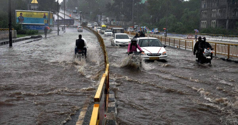
Well-marked low pressure area moved from Odisha to North Chhattisgarh. It is likely to move westward to reach Madhya Pradesh, shortly. Heavy to very heavy rains are expected over Madhya Pradesh and parts of Maharashtra for the next 3 days. Rainfall in excess of 100mm in 24 hours is quite likely over Southwest Madhya Pradesh, North Madhya Maharashtra, South Coastal Gujarat and Konkan during this period.
Well-marked low pressure has already lashed the entire state of Chhattisgarh and contiguous parts of Vidarbha and East Madhya Pradesh with heavy rains in the past 24 hours. Prominent stations receiving heavy downpours among many others were: Bilaspur (136mm), Raipur (118mm), Mana (74mm), Durg (68mm), Gondia (116mm), Malanjkhand (167mm). Heavy rainfall belt will now shift westward over West Madhya Pradesh and Madhya Maharashtra. Neighbouring regions of Gujarat and Rajasthan will also receive decent showers. Weather conditions will start becoming better from 20th September onward.
Extremely heavy rainfall is likely on 16th and 17th September over meeting joints of southwest Madhya Pradesh and North Madhya Maharashtra. Stations like Khargone, Khandwa, Indore, Ujjain, Harda, Dewas, Burwani, Dhar, Nandurbar, Jalgaon, Dhule, Nasik, Pune and Ahmednagar will be at risk of receiving downpours. Localized flooding, inundation of low-lying areas and disruption of road and air traffic is quite likely. Heavy thunderstorms and lightning strikes, accompanied by strong gale-speed winds may impact connectivity. Remnant of the weather system will cut across the interiors of Gujarat on the 18th and 19th of September and the region will have much-awaited monsoon bursts at many places.


