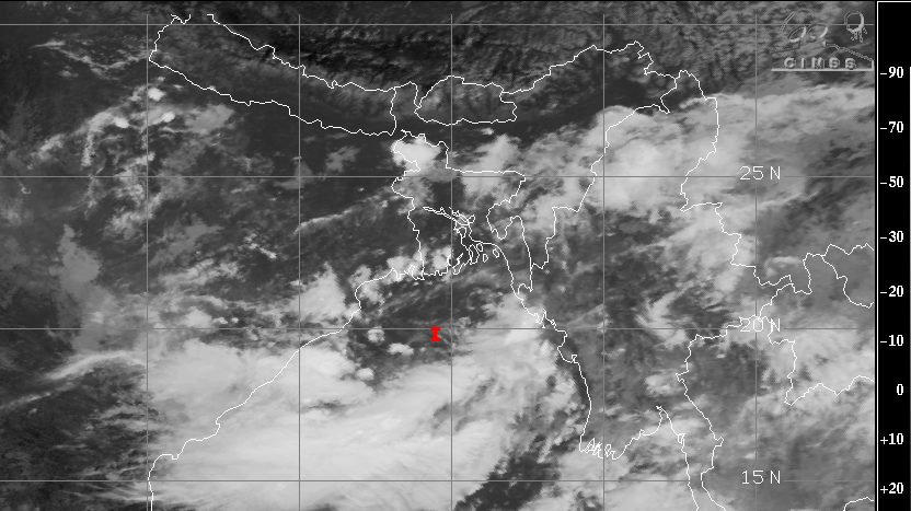
Much anticipated low pressure area has finally formed over North Bay of Bengal. Center of low pressure area is marked around 20°N and 89°E, about 300km east abeam Bhubaneshwar. It is likely to become well marked low pressure area in the next 24hours. It is expected to cross Odisha coast in the subsequent 24hours. The system may retain its intensity over land and could possibly become a depression, albeit for short duration. This will trigger active to vigorous monsoon conditions, largely over central parts of the country. Intense rainfall belt will travel from east coast to the west coast, across central parts.
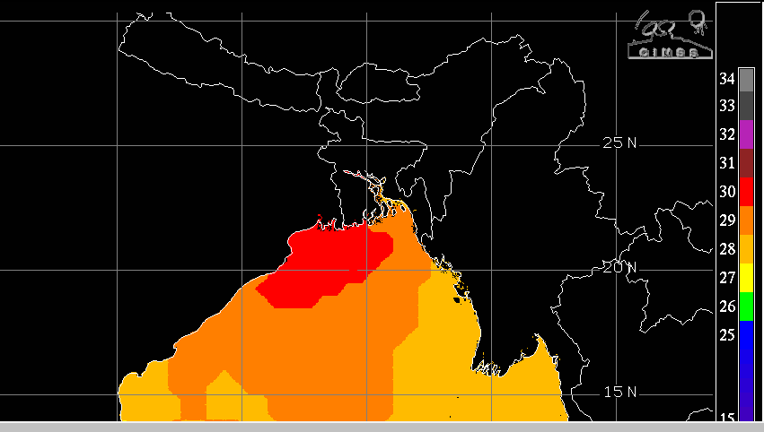
Ocean surface is fairly warm around the center of the low pressure, with temperature around 30°C right till the coastline. This heat energy will allow the system to sustain or grow its strength. A broad cyclonic circulation around the center of system is churning winds in excess of 40kmh. Intensified system will have potential to generate gusty winds in excess of 50kmh along and off the coast and even over land.
Widespread rain and thundershowers are likely, with heavy to very heavy bursts, for the next 4-5 days over central parts in a staggered manner. The east-west oriented shear zone of the system will facilitate weather activity, far ahead of the center of the system during this period. To start with, Odisha and Chhattisgarh will have heavy rainfall on 13thand 14thSeptember. Possibly, the intense rainfall may extend to East Madhya Pradesh on 14thSeptember itself and later cover the entire state on 15thSeptember, along with peripheral areas of Vidarbha on left and Uttar Pradesh on right of track. On the subsequent 2 days, on 16th & 17thSeptember, the spread and intensity of the weather system will increase and cover West Madhya Pradesh, Marathwada, Madhya Maharashtra, Konkan and Southwest Uttar Pradesh. Streaks of cloud cluster will even reach parts of south and east Rajasthan on the last 2 days.
Strong thunderclouds with lightning storms and damaging gusty winds will be the hallmark of this monsoon system. Flooding rains, inundation of low lying areas and disruption of traffic in some pockets remains a strong possibility. However, most southern parts of the country, interiors of Gujarat and West Rajasthan, once again, are likely to be left out with any significant weather activity. Rains also will not reach effectively up to the northern states of Punjab, Haryana and North Rajasthan. National capital may come in for some stray showers, for brief intervals, between 14th& 17th September.