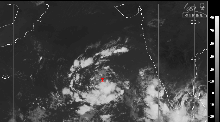
Under the influence of cyclonic circulation over Lakshadweep and Southeast Arabian Sea, a low pressure area has formed over Southeast and adjoining East-Central Arabian Sea. The invest area is centered around 12.3°N and 67.3°E, nearly 700km away from the coast, in to the sea. It is likely to become well marked in the next 24hours and strengthen further subsequently. It is expected to move west-northwestward, thereby increasing its distance from the Indian coastline.
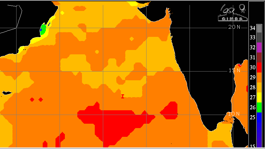
Cloud configuration around the low pressure has started organizing, dominated by convective clusters taking circular shape. Presently, the low pressure is lying over very warm sea surface with temperature around 30°C. Adequate heat potential will support growth of the system for the next 2-3 days. The environmental conditions, including the marginal wind shear will be supportive of further deepening of weather system.
There is still no clarity on the fate of this weather system, as it moves over Southwest and Western parts of Arabian Sea. Precarious weather conditions over these parts exhibit divergent outcomes. There is lack of consensus amongst various numerical models on the track, timelines and intensity of the system, as of now. No conclusive prediction is possible at this juncture. The brewing disturbance essentially need to be kept under observation for the next 3 days.

Majority of models track this likely storm, heading for Yemen- Oman coast. However, the GFS models are suggesting recurvature while positioned over deep central parts of Arabian Sea and steering the system towards Pakistan and Gujarat coast. Sea surface temperatures, as such, are dropping over western and northern parts of the Arabian Sea. It is a very common observation, around this part of the season. Such a scenario degrades the evolving storms, over the sea itself. Also, the uncertainties of model skills need to be convolved with delicate and tricky oceanic conditions, over those parts, to predict reliable outcome.
Possibility of a potential tropical storm, the first one of the season this year, within the existing envelope of oceanic and environmental conditions remain obsessed. Chances of development of a cyclone far exceed the rare probability of abating. Three days of observation period becomes crucial and decisive, to commit reliable forecast.


