Madhya Pradesh has been witnessing the varied intensity of rains from the past few days. However, the rain intensity in the last 24 hours has increased considerably over the south and southeastern parts of the state in contrast with the regions of West Madhya Pradesh. Though overall the entire state received good rains.
[yuzo_related]
In the last 24 hours from 8.30 am on Friday, Khandwa witnessed extremely heavy rain of 148 mm, Hoshangabad 54 mm, Umaria 38 mm, Indore 31 mm, Bhopal 28 mm and Guna 21.6 mm of rain. Seoni recorded moderate rain of 14 mm, Pendra Road 16 mm, Bilaspur 19 mm and Chindwara 9 mm of rain.
These hefty rains can be attributed to the axis of Monsoon trough which is shifting further southwards. At present, it is moving across Punjab, Haryana, Uttar Pradesh, Chhattisgarh, and Odisha. Another cyclonic circulation has developed as a Low-Pressure Area over Odisha which is extending tilting southwestwards.
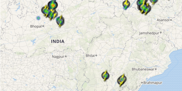
Click the image below to see the live lightning and thunderstorm across Madhya Pradesh
These two combined systems have lashed the state with good rains. Moreover, now, The axis of Monsoon trough is likely to pass via Madhya Pradesh and therefore, rains are expected to continue in parts of the state for another 24 to 48 hours. The southern and southeastern parts will continue recording moderate to heavy rains, meanwhile, rain intensity will also increase over the northern parts of the state.
As on August 18, Madhya Pradesh is rain deficient by 23 percent and with these rains, the rain deficiency is expected to reduce.
IMAGE CREDIT: financialexpress.com
Any information taken from here should be credited to skymetweather.com


