

Good rains have kept the weather of the northern hills pleasant and worth touring. Southwest Monsoon has kept itself constructive over the northern hills of the country. Altogether, rains over Himachal Pradesh and Uttarakhand did wonders while rains over Jammu & Kashmir remained on a comparatively lower side.
Though the last 24 hours proved out to be constructive for Jammu & Kashmir as well when most parts of the state had observed good rains. Within the span of 24 hours from 08:30 am on Friday,Dehradunrecorded 27 mm of rains, Shimla 25 mm, Banihal 24 mm, Jammu 21 mm, Tehri 18 mm,Haridwar8.2 mm whileManaliwitnessed merely 1 mm of light traces.
[yuzo_related]
As per Skymet Weather, the Western Disturbance was moving across Jammu & Kashmir as an upper air cyclonic circulation. In the wake of this, scattered moderate rains were observed over Himachal Pradesh and Uttarakhand and light to isolated moderate spells were recorded in parts of Jammu & Kashmir.
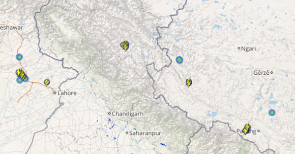
Click above to see the live lightning and thunderstorm across Northern hills
However, as the Western Disturbance is now moving away, the rainfall activity is likely to reduce over the hilly states. Moreover, the cyclonic circulation over Punjab has also become insignificant now which is also one of the reasons for the reduction in rainfall activities over Northern hills.
The maximum temperature due to reduced rainfall activities will rise over Jammu & Kashmir and Himachal Pradesh. However, scattered light rain will continue over the eastern parts of Jammu & Kashmir and Himachal Pradesh. Uttarakhand can brace for some light to moderate rains for the next 24 hours, reducing gradually by Monday. However, morning will be pleasant over hills with cool and dry winds.
ImageCredit: Facebook
Any information taken from here should be credited to skymetweather.com


