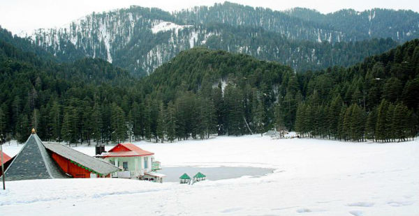
The hills of Jammu and Kashmir normally experiences snowfall activity during the month of December. However, this year snowfall made its appearance a little early and few places over the state observed snowfall during the first half of November only.
In fact, few higher reaches of Jammu and Kashmir recorded snowfall activity even during October. On November 3, heavy rain and snowfall activity was observed over the capital city of Srinagar. Further, on November 12, widespread rain and snowfall activity was witnessed over many popular hill stations such as Srinagar, Gulmarg, Pahalgaon etc. along with few higher reaches of Himachal Pradesh.
However, since then, in absence of any significant weather system over the hills of North India, the weather remained almost dry with scattered rain and snow over isolated pockets of the state.
However, we now expecting a good spell of rain and snow over the hills. At present, a Western Disturbance lies over North Pakistan and its adjoining region. This system lies in close proximity of Jammu and Kashmir. Therefore, currently the entire state is covered with intense clouding.
During the next 24 hours, we expect heavy rain and snowfall activity over the higher reaches of Jammu and Kashmir and Himachal Pradesh. Many popular hill stations such as Srinagar, Gulmarg, Pahalgaon, Manali, and Shimla may also receive good rain and snow. In fact, isolated activities over the higher reaches of Uttarakhand also cannot be ruled out.
Due to these rains, day temperatures will drop significantly and night temperatures may show marginal rise. However, as the movement of this weather system is fast in nature, it will be clearing out soon i.e. in the next 24 hours which will lead to decrease in weather activities and once again rise drop in night temperatures.
Image Credits – Pininterest
Please Note: Any information picked from here must be attributed to skymetweather.com


