Intensity and frequency of Western disturbances will reduce now

March 12, 2022 9:04 PM|

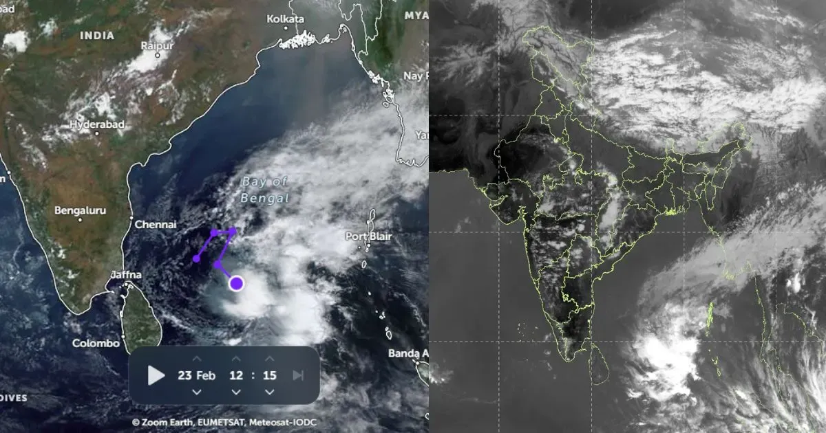
Western disturbance are systems which originate over Mediterranean Sea and move in easterly direction towards Western Himalayas. They usually give winter rains and snowfall over states of Western Himalayas and winter rains over Indo Gangetic plains.

As they move from west to east that is why they are called as western disturbances. The moisture of these systems usually originates over Mediterranean Sea, Caspian Sea and Black Sea.

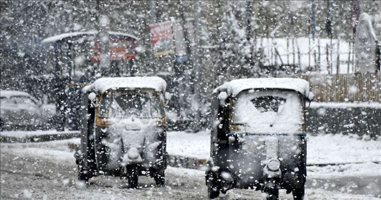
Their impact starts from the month of October and continues until March over Western Himalayas. Peak intensity is during December and January when heavy snowfall occurs over hilly states of Western Himalayas leading to mudslide, landslides and avalanches. As the sun starts moving towards Northern hemisphere in the latter part of March, western disturbance also starts moving North over upper latitudes.

Now we are approaching mid-March therefore the intensity and frequency of Western disturbances will start reducing. Chances of moderate to heavy snowfall over Western Himalayas are almost nil. However, weak Western disturbances may continue until third week of March which may give isolated a rain and slow over upper reaches of hilly States.

Similar Articles

thumbnail image
March 20, Today Marks The Spring Equinox: Day-Night Duration Nearly Equal

The official transition from winter to spring, known as the SPRING EQUINOX, occurs today! It’s time when the Sun crosses the celestial equator precisely at 2:31 PM, delivering warmer, longer days to the Northern HemiSphere. As autumn arrives, the South enjoys colder evenings.

posted on:
thumbnail image
आज सूर्य करेगा भूमध्य रेखा पार, बसंत ऋतु की शुरुआत, दिन-रात की अवधि लगभग बराबर

आज, 20 मार्च 2025, बसंत विषुव (Spring Equinox 2025) का दिन है। सूर्य भूमध्य रेखा को पार करेगा, दिन बड़े और गर्म होंगे। उत्तर गोलार्ध में बसंत ऋतु की शुरुआत होगी, दक्षिण गोलार्ध में शरद ऋतु का आगमन होगा। वहीं, सितंबर में यह खगोलीय घटना फिर से होगी।

posted on:
thumbnail image
गर्मी का दायरा बढ़ा! ओडिशा, महाराष्ट्र, तेलंगाना और रायलसीमा में 40°C के पार तापमान, राहत की उम्मीद

देश में समय से पहले गर्मी असर बढ़ रहा है। ओडिशा, महाराष्ट्र, तेलंगाना, आंध्र प्रदेश में अभी तापमान से 40°C से ऊपर पहुंच गया है, जिस कारण इन राज्यों में भीषण गर्मी हो रही है। फरवरी 2025, पिछले 125 वर्षों में सबसे गर्म महीना रहा है। कई जगहों पर सामान्य से 6.4°C तक ज्यादा तापमान रिकॉर्ड हुआ है।

posted on:
thumbnail image
दिल्ली में बढ़ेगी गर्मी! शुष्क और तपता रहेगा वीकेंड, बारिश की संभावना हुई कम

दिल्ली में गर्मी बढ़ रही है, पिछले 3 दिनों में तापमान 4°C बढ़ा है। आज अधिकतम 34-35°C, न्यूनतम 17°C तक रह सकता है। मार्च अब तक लगभग शुष्क बना हुआ है, सिर्फ 2mm बारिश दर्ज हुई है। 26-28 मार्च को तापमान 40°C के करीब पहुंचने की संभावना है। वहीं,पश्चिमी विक्षोभ से मैदानी इलाकों में बारिश की संभावना नहीं है।

posted on: